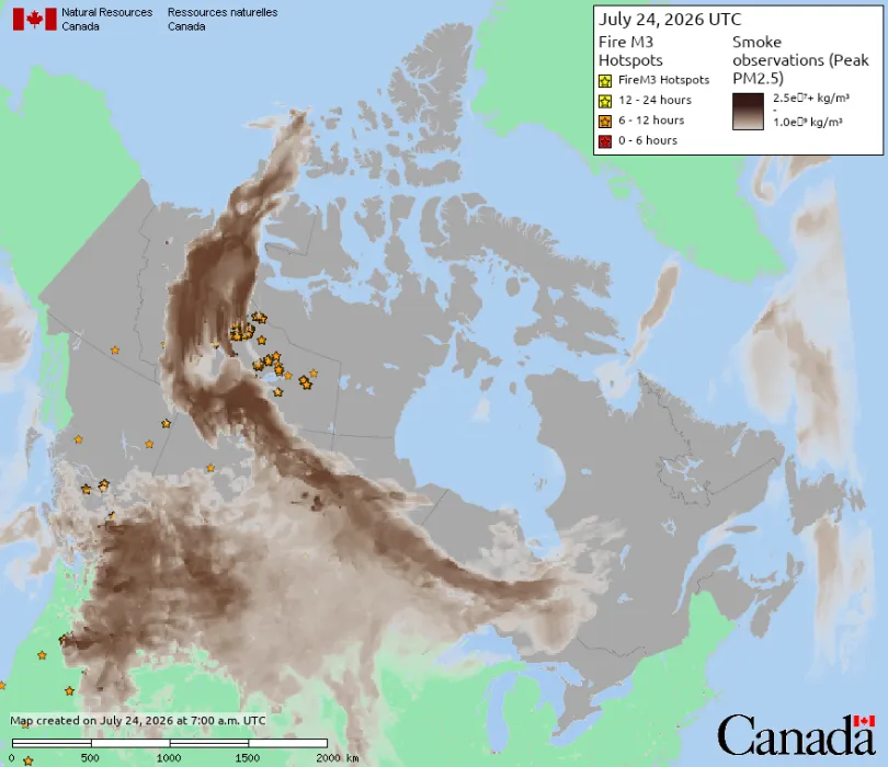
In mid-July 2026, smoke from wildfires burning across central Canada continued spreading southeast across the U.S.-Canada border, pushing Detroit’s Air Quality Index to its highest reported level since monitoring began in 1999. Several cities were listed among the most polluted major cities in the world during this period.
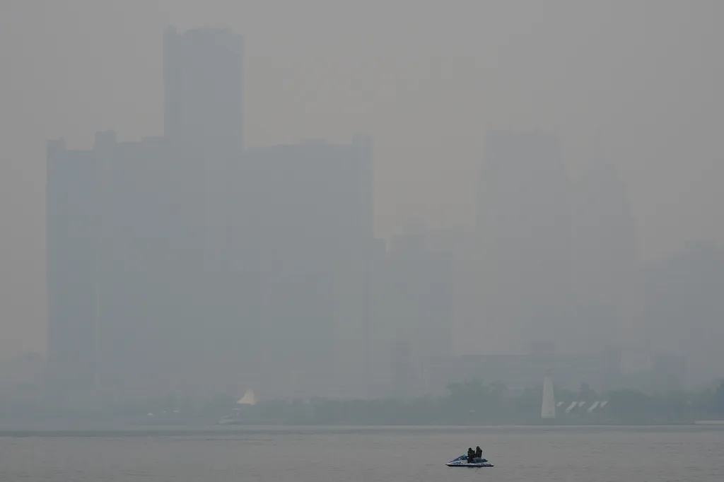
A watercraft sits in the Detroit River near the skyline during poor air quality due to smoke from Canadian wildfires Thursday, July 16, 2026, in Detroit.. (AP Photo/Paul Sancya)
The source of this cross-border smoke event was widespread wildfire activity across Canada, with many active fires classified as out of control or being monitored.As of late July, Canada had recorded more than 3,100 wildfires for the year, with total burned area exceeding 2.8 million hectares. Smoke can travel hundreds or even thousands of kilometers and affect millions of people far from the fire itself, depending on the volume of emissions, plume injection height, prevailing winds, and atmospheric conditions.This also points to a core challenge in wildfire management: when fire activity expands to an uncontained scale within a short period and produces wide-ranging secondary effects, can management agencies identify risk early enough, track conditions as they change, and continue monitoring impact after the fact?
Similar conditions emerged across parts of Europe in late July. A wildfire in the Castilla-La Mancha region of central Spain burned more than 32,000 hectares, making it the second-largest wildfire recorded in Spain this century and the largest on record in Castilla-La Mancha. According to Spain’s Minister for Ecological Transition, Sara Aagesen, more than 100,000 hectares had burned nationwide in 2026, broadly in line with the country’s average for an entire year over the previous decade.In southwestern France, a rapidly spreading wildfire near Bordeaux forced around 20,000 residents and vacationers to evacuate. In Scotland, very high wildfire-risk warnings were issued as a fire in Cairngorms National Park continued burning for more than a week.Meanwhile, the U.S. National Interagency Fire Center raised the national preparedness level to 5, its highest classification. By July 20, more than 40,000 wildfires had been recorded across the United States in 2026, burning over 3.9 million acres, with smoke from Canada adding further strain to air quality across the Midwest and Northeast.
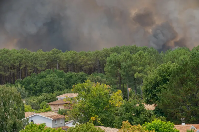
Smoke rises over wildfires in the Lège-Cap-Ferret region, western France,Thursday, July 23, 2026. (AP Photo/Caroline Blumberg)
From North America to southern Europe, wildfires and their secondary effects present a cross-regional, cross-sector environmental management challenge.
Why Wildfire Conditions Are Becoming More Severe and Fires Harder to Contain
Wildfire behavior and spread are shaped by multiple interacting factors. Heat released by intense combustion can lift smoke higher into the atmosphere and, in some cases, above the atmospheric boundary layer, where winds can carry it over long distances. Where that smoke ultimately travels depends on fire intensity, plume injection height, wind speed and direction, atmospheric stability, temperature, humidity, and terrain.
These events have occurred against a backdrop of sustained heat and dry conditions across parts of Europe and North America. Elevated temperatures accelerate moisture loss from soil and vegetation, and when dry fuel, low humidity, and strong winds coincide, fires tend to spread more rapidly. According to the World Meteorological Organization, El Niño conditions have developed in the tropical Pacific and are expected to strengthen during the third quarter of 2026—a pattern that can alter regional probabilities of heat, drought, heavy rainfall, flooding, and other extreme weather.
It should be noted that heat or El Niño conditions do not, on their own, provide a deterministic explanation for any inpidual wildfire. Ignition sources, local weather, vegetation conditions, and terrain all factor into whether and how a given fire develops. A more accurate description is that these climatic conditions are among the factors that can elevate wildfire risk in certain regions, rather than a direct cause of any single event.
Climate and weather conditions can help explain both why landscapes become conducive to ignition and why fires may spread rapidly or become difficult to contain. Whether a fire escalates depends on a combination of fuel conditions, weather, terrain, accessibility, available suppression resources, detection speed, and monitoring capabilities.
Limitations of Traditional Monitoring Approaches
Ground patrols, field reporting, and aerial observation remain important components of wildfire risk assessment, fire tracking, and post-fire evaluation, alongside satellites, automated sensors, weather data, and predictive models.These approaches can provide detailed, high-resolution information for a specific location, but face several structural limitations when applied to wildfire management at scale and over time.
Ground patrol coverage is inherently limited. Wildfire-prone areas tend to be remote, forested, and difficult to access by road, making it hard for ground crews to maintain continuous coverage across large areas or to detect early-stage vegetation stress or ignition in time. Explore application overview →
Aerial monitoring carries its own constraints. It requires trained pilots and observers, and identifying fire activity under heavy smoke or reduced visibility places significant demands on both personnel and equipment. Sustained aerial coverage across large areas can also be difficult to maintain because of its cost and operational requirements.
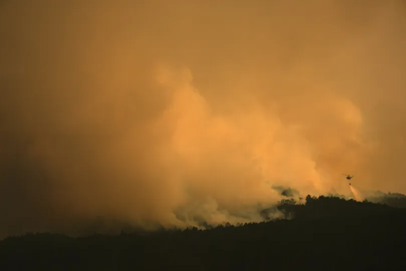
A firefighting helicopter drops water on the flames as a wildfire advances near Condemios de Arriba, Guadalajara province, Spain, Wednesday, July 22, 2026, after a wildfire scorched tens of thousands of hectares in one of Spain’s largest wildfires in recent years. (AP Photo/Manu Fernandez)
Beyond this, wildfire management involves more than determining where a fire is currently burning. Before a fire starts, agencies need to identify which areas have dry, high-flammability vegetation. While a fire is active, they need to track its extent and behavior as it changes. After a fire is contained, they still need to assess burned area, vegetation recovery, and broader ecological impact. The kind of sustained, repeated observation these stages require is difficult for ground- and aircraft-based methods alone to provide consistently.
From Risk Identification to Post-Fire Assessment: Where Satellite Data Can Help
The value of satellite-based Earth observation in wildfire management tends to concentrate in three stages.
Before a fire starts, satellite data can help identify areas with dry vegetation and elevated fire risk. Indices such as the Normalized Difference Vegetation Index (NDVI), which indicates vegetation greenness and condition, and moisture-sensitive indices such as the Normalized Difference Moisture Index (NDMI) can support the monitoring of vegetation stress and changes in canopy moisture, which can be compared against historical seasonal patterns to map areas of abnormal drought stress. Ground-based sampling at this density and scale is difficult to sustain across large areas; satellite observation offers a complementary approach with broader coverage and repeatable measurement, which, when combined with weather, fuel, and local field data, can help forestry and fire agencies prioritize patrol routes and support early risk advisories.
While a fire is active, thermal infrared sensors can detect anomalous heat signatures associated with active burning, supporting the identification and monitoring of new and ongoing fire activity, including in locations that are difficult for ground crews to reach. Repeated observations can also help analysts assess changes in detected fire activity and affected area over time.Atmospheric and aerosol-sensing instruments can help characterize the direction and extent of smoke plumes. When combined with ground-level air-quality data and official advisories, this information can support utilities and infrastructure operators in planning outdoor work and inspections.It’s worth noting that satellite detection of smoke over a given area does not necessarily mean ground-level air quality has deteriorated there; a reliable assessment typically requires combining plume location and altitude data with wind patterns, atmospheric dispersion modeling, and ground-based monitoring, rather than relying on a single data source.
After a fire is contained, satellite imagery can support burned-area assessment and long-term tracking of vegetation recovery. Comparing pre- and post-fire multispectral imagery using the Normalized Burn Ratio (NBR) and its change metric, dNBR, can help estimate burned extent and support burn-severity assessment. Ongoing time-series observation afterward can track the pace of vegetation regrowth and flag areas where recovery is slower or shows unusual patterns — information that supports post-fire evaluation and restoration planning for forestry and environmental management agencies. This kind of long-term, repeatable observation is difficult for ground-based surveys alone to sustain given cost and staffing constraints. In a similar way, burned-area and impact records built from historical and near-real-time satellite data can provide supplementary evidence for wildfire risk assessment, underwriting, and claims review when combined with policy, incident, and field information. Explore application overview →
Turning Multi-Source Data Into Actionable Decisions with STARPATH GLOBAL
One of the more common practical challenges in wildfire risk management isn’t a lack of data — it’s that satellite imagery, weather models, ground monitoring, and historical records tend to sit in separate systems, differing in timing, resolution, and format, making them difficult to consolidate into a usable basis for decision-making within a limited window of time. This is also why some organizations, even when already using satellite data, still struggle to turn it into a stable, sustainable monitoring workflow.
STARPATH GLOBAL’s Forward Deployed Engineer (FDE) approach starts with a client’s specific business challenges and existing workflows rather than with a predetermined satellite or dataset. Our engineers work with client teams to identify high-value monitoring opportunities, design practical workflows, and evaluate them against defined operational and business metrics—whether for pre-fire risk screening, active fire and smoke monitoring, or post-fire vegetation recovery assessment.
Through the STARPATH GLOBAL Pioneer Partner Program, selected organizations can receive a free opportunity assessment and value-validation process. STARPATH GLOBAL covers the cost of opportunity identification, solution design, qualifying on-site engineering support, and ROI validation for selected Pioneer Partners. No formal procurement commitment is required until the expected business value has been demonstrated.