Indonesia’s 2026 fire season is highlighting the operational and land-management risks facing plantation and forestry operators.
According to AFP’s 11 November 2026 report, Nusantara Atlas estimated that approximately 2.88 million hectares of land in Indonesia were affected by fire between January and October 2026, exceeding the full-year 2019 figure in the same monitoring series. Smoke has obscured some burn scars, and the estimate may be revised as additional observations become available.
In an announcement published on 11 November 2026, Indonesia’s ATR/BPN ministry described five categories of HGU-related measures involving 11 companies in Kalimantan. These included recommendations to cancel all or part of existing rights, state takeover of land with expired HGU, non-issuance of HGU and further investigation. Repeated fires, inadequate fire prevention facilities and failure to meet relevant conditions were among the factors considered by the authorities.
On 12 November 2026, Greenpeace, Nusantara Atlas and Pusaka Bentala Rakyat reported that their analysis had identified 2,270 haze-source points within 264 oil palm concessions between 8 August and 31 October 2026. These spatial findings warrant further investigation; they do not, by themselves, establish who started the fires or determine corporate liability.
The scale of the fires, measures concerning land rights and concession-level checks mean that wildfire prevention and response are no longer simply a matter of “disaster prevention and loss reduction.” For large plantation operators, forestry companies and land operators, wildfires are increasingly becoming a business risk directly tied to the continuity of land operations, corporate responsibility and external scrutiny.
Identifying areas that need action earlier and maintaining reliable records of verification, response and follow-up inspections are becoming parts of the same management task.
By the Time Dense Smoke Appears, the Best Window for Response May Already Have Passed
The 2.88 million hectares of burned area reflect the severity of the 2026 fire season, but they also highlight a more practical problem: once fires have spread over large areas and dense smoke has set in, companies often have far fewer response options.
Nusantara Atlas noted in its burned-area estimate that dense smoke affects some satellite imagery, meaning the current figure may still underestimate the actual area burned. Once a fire occurs, companies may face both pressure to respond and gaps in information. When observation conditions are constrained, the plot information, risk assessments and patrol arrangements developed through routine work become even more important.
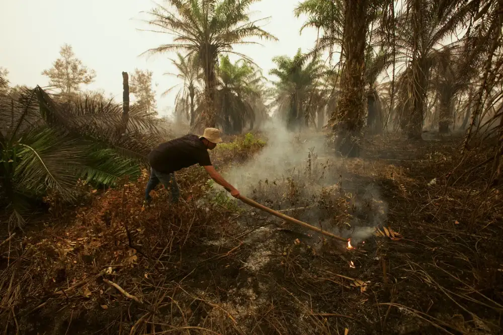
A wildfire in Pulang Pisau, Central Kalimantan, Indonesia, on October 14, 2026. Photo: Salim Van Java
For operators managing large areas of land, waiting until visible smoke plumes emerge, field reports arrive or widespread thermal anomalies appear before monitoring truly begins can quickly leave prevention and response efforts in a reactive position. A more effective approach is to narrow down areas of concern in advance during the dry season and other high-risk periods, directing limited patrol resources toward plots that warrant closer attention.
Companies can begin their routine wildfire monitoring by combining information on historically fire-affected areas, land cover, peat and drainage conditions, and recent rainfall and weather changes to identify plots that deserve priority attention. Patrols should be intensified in areas repeatedly affected by fire, experiencing prolonged low rainfall or where hazards have previously been identified. Resources should also be positioned in advance, taking account of roads, water sources and personnel locations.
Building on this, ongoing attention to new or recurring thermal anomalies can help teams move from broad-area patrols to targeted checks. Observation times, anomaly locations and surrounding conditions can inform the order in which checks are carried out, with drones or field personnel then confirming the actual fire situation.
Small, low-temperature or obscured smoldering fires may still go undetected, so proactive monitoring needs to work alongside routine patrols and ground information. Its practical value is in helping teams establish priority areas in advance and organize verification and response more quickly once an anomaly appears.
Any Single Monitoring Method Has Limitations
Identifying priority areas in advance is only the first step. Once an anomaly requires a response, companies are usually not “completely unaware of what is happening.” They often already have some clues, but those clues are not yet sufficient to support action.
Thermal anomalies can provide indications of fire, but they still need to be verified against other observations and field information. Optical imagery can provide a visual picture of the land surface, but clouds and dense smoke may affect it. When an anomaly appears near a boundary, land records are also needed to assess its position relative to the boundary and whether cross-boundary spread may be involved.
The purpose of multi-source monitoring is therefore not simply to “look at more data,” but to reduce gaps in decision-making as quickly as possible.
Optical imagery can help reveal the surface context and visible changes; thermal anomaly products can provide frequent clues; and meteorological data can help assess conditions for fire spread. When clouds and smoke limit optical observations, SAR can provide supplementary information on certain surface changes, while drones and ground personnel provide further confirmation of conditions on site.
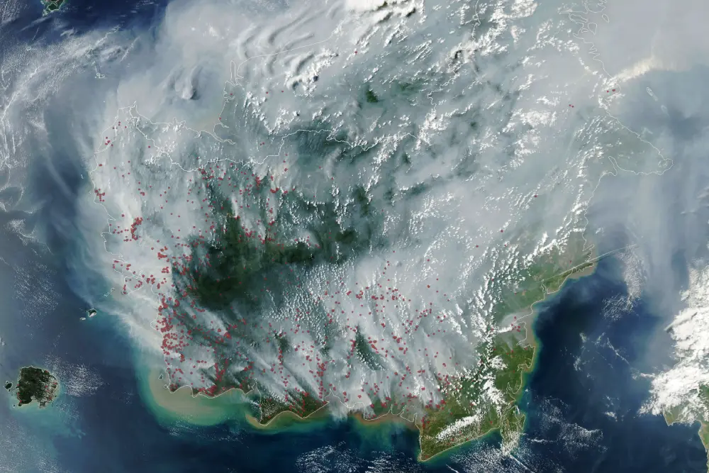
Smoke from fires over Borneo, captured by MODIS aboard NASA’s Aqua satellite on September 1, 2026. Credit: NASA
These data sources do not all need to be used at the same time. What matters is being able to draw on other sources when one type of information is insufficient to support a judgment, so that an event does not stop being tracked simply because the view is “unclear” at a particular moment.
For example, when a new anomaly appears near a boundary, the team first needs to understand how it relates to past fires, land boundaries and recent weather. It can then use information about roads, personnel and water sources to decide whether an on-site check is needed. Satellites, drones and ground personnel each provide information at different levels, but all ultimately serve the same purpose: helping managers determine as quickly as possible whether the risk genuinely requires action.
In this way, multi-source remote sensing becomes more than a technical exercise in “data fusion.” It becomes a way for companies to shorten assessment times and use field resources more efficiently.
As Concession Areas Come Under Retrospective Scrutiny, Companies Need Their Own Incident Records
External checks are increasingly focusing on inpidual plots.
ANTARA reported on November 9 that Indonesia’s National Disaster Management Agency, BNPB, is developing a system that integrates spatial data with licensing information, linking hotspots and fire-affected areas to land records such as HGU. Findings from this spatial analysis still need to be verified in the field.
This poses a practical question for companies: If external organizations can trace fire activity on a plot, can the company itself also reconstruct what happened at the time?
When an anomaly was first detected, which version of the boundary was used, when personnel received the information and arrived on site, what measures they took, and whether follow-up inspections were conducted all need to be supported by relevant records.
Even when a company has taken action, it may struggle to quickly provide a clear account if imagery, patrol photographs, work chat messages and response forms are stored separately. Organizing historical imagery and multi-temporal satellite data by plot and time, while continually adding field findings, response measures and follow-up inspection results, can help teams reconstruct events and keep unresolved issues under review.
Each record should also retain its source, observation time and boundary version, and note any data gaps. This allows different personnel to review the basis for assessments and distinguish what has been confirmed from what still requires verification.
These records can also improve routine prevention and response. Managers can examine why anomalies have reappeared at the same location, whether earlier measures were effective and which corrective actions still need follow-up.
Relevant supply chains serving the EU market also need to prepare the information on origin, deforestation-free status and legal production required under the EUDR. Reliable plot records can support some of these checks, while each requirement still needs to be met separately.
Historical imagery can help reveal past surface changes, but it cannot fill in records of field actions that were not documented at the time. A verifiable management process needs to be built continuously through day-to-day work.
Integrating Continuous Observation into Daily Prevention and Response
Proactive risk identification and post-incident verification can be based on the same set of continuously updated plot information.
The demands this fire season places on companies ultimately have to translate into specific tasks: where limited patrol resources should go first, who takes responsibility for new anomalies, whether follow-up inspections continue after a response, and whether management can clearly see how the plots concerned have changed over time.
These questions should also be the starting point for choosing a monitoring service.
STARPATH GLOBAL has a regional presence in Southeast Asia, including Jakarta, Kuala Lumpur and Singapore. To address the needs of plantation groups, commodity traders and forestry management organizations in Indonesia and surrounding areas, we can work with clients to define monitoring objectives and the scope of implementation, focusing on priority plots, verification methods and field feedback.
Building on a company’s existing plot records, patrol resources and management processes, STARPATH GLOBAL can configure suitable satellite monitoring and analysis solutions and integrate them with weather, drone and field information to help teams identify priority areas, track anomalies and continually record verification and response outcomes.
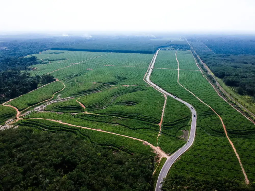
Aerial view of the Asahan–Lima Puluh road and oil palm replanting areas in North Sumatra, Indonesia, October 2017. File photo. Photo: Irawangp
Companies can start with one high-risk estate to test whether monitoring outputs help adjust patrol priorities, support anomaly verification and maintain follow-up on response outcomes. Once validated, suitable approaches can then be extended to additional plots.
For operators facing the pressures of fire season and external scrutiny, the capabilities developed in this way support immediate prevention and response while enabling companies, when asked, to clearly explain when a change was first observed, what actions were taken and what still needs to be confirmed.
Discuss Your Estate Monitoring Needs with STARPATH GLOBAL’s Local Team →