Commercial space is entering a new phase of large-scale development, with the number of satellites in orbit continuing to rise and applications expanding into an increasingly diverse range of industries. Ultimately, however, the value of the industry is realized through data applications and services.
Among these applications, 3D stereo mapping has become an important field of satellite remote sensing, providing increasingly critical foundational support for natural resource surveys, urban planning and construction, disaster assessment and management, infrastructure monitoring, and other applications.
To further strengthen its stereo mapping capabilities, Chang Guang Satellite Technology Co., Ltd. (CGSTL) has addressed several longstanding industry challenges, including long acquisition cycles for stereo data, insufficient resolution, and limited availability of multi-angle imagery.
The company has developed key technologies including satellite-based integrated intelligent imaging, coordinated stereo observations using multi-satellite formations, and automated production of multi-view 3D models.
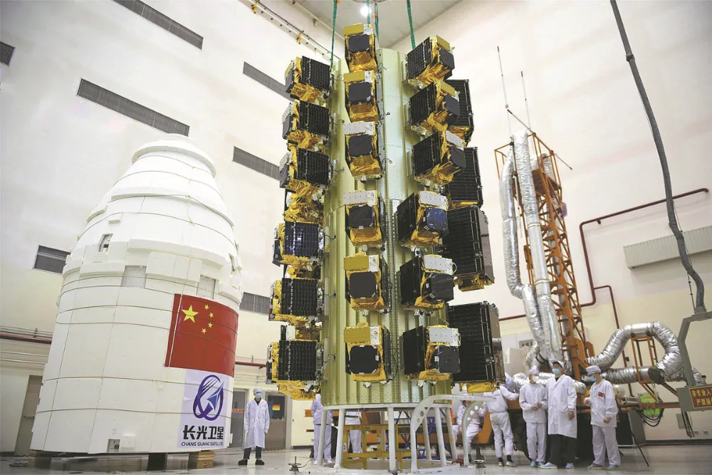
CGSTL has successfully launched 19 next-generation high-resolution optical remote sensing satellites with high-precision stereo mapping capabilities, creating what it says is currently the world’s largest stereo mapping satellite cluster. Based on this constellation, the company has now officially unveiled a portfolio of high-precision 3D mapping products.

Illustration of the Jilin-1 stereo mapping satellite cluster
Major Leap in Satellite Stereo Mapping Opens a New Era of Constellation-Based 3D Reconstruction
The satellite cluster supports multiple stereo imaging modes, including single-satellite along-track stereo imaging, dual-satellite formation stereo imaging, and multi-satellite, multi-view stereo imaging.
A dual-satellite formation can capture a single imaging strip as long as 1,600 kilometers, with a single stereo imaging operation covering more than 20,000 square kilometers.
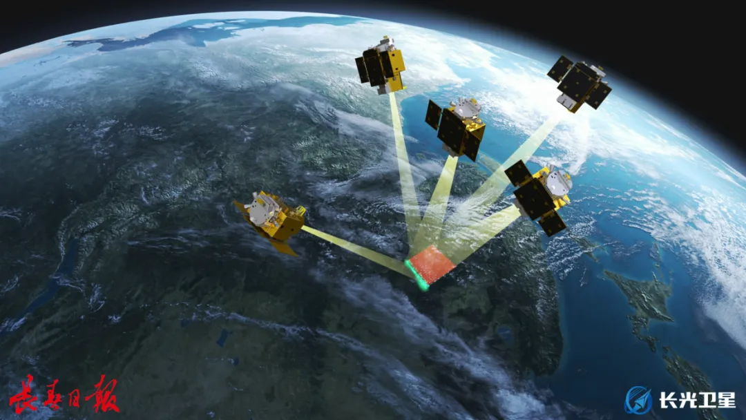
Illustration of a five-satellite Jilin-1 formation
Through coordinated scheduling of its large satellite cluster, CGSTL has transformed its stereo imaging capabilities from single-pass stereo acquisition to coordinated multi-view observations by multiple satellites, from local mapping to large-area stereo coverage, and from periodic updates to high-frequency dynamic reconstruction.
These capabilities are helping move satellite stereo mapping toward faster dynamic updates and more detailed 3D reconstruction.
High-Precision 3D Product Portfolio Supports Applications Across Multiple Industries
Leveraging the cluster’s stereo data acquisition capabilities, CGSTL has developed a portfolio of 3D mapping products spanning both basic and advanced products, with accuracy specifications reaching internationally advanced levels.
At the basic product level, the company can use the maneuverability of individual satellites to provide two-view and three-view stereo image-pair data. Through coordinated observations by multiple satellites, the cluster can also acquire five-view stereo image-pair data.
Observations from multiple angles can compensate for occlusions and blind spots around building façades, complex rooftop structures, and steep terrain, significantly improving the completeness of surface textures, geometric reliability, and level of detail in 3D models.
At the advanced product level, the system can efficiently produce high-precision digital surface models (DSM), high-precision digital elevation models (DEM), 3D white models, and photorealistic 3D models.
CGSTL uses its independently developed CG-3D high-precision stereo data production engine to substantially improve the production efficiency and response speed of advanced products while maintaining product accuracy.
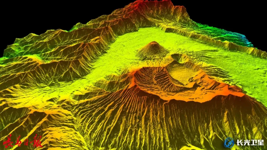
High-precision Jilin-1 digital surface model (DSM) of Mount Bromo, Indonesia
The product portfolio can be widely applied to natural resource surveying and management, mapping and planning, engineering surveys, water resources and environmental protection, energy infrastructure monitoring, emergency disaster assessment, and digital city development.
It can also provide routine data support for China’s Real-Scene 3D China initiative. In situations where drone flights are prohibited or other forms of data acquisition are restricted, satellite stereo mapping can also serve as a reliable alternative data source.
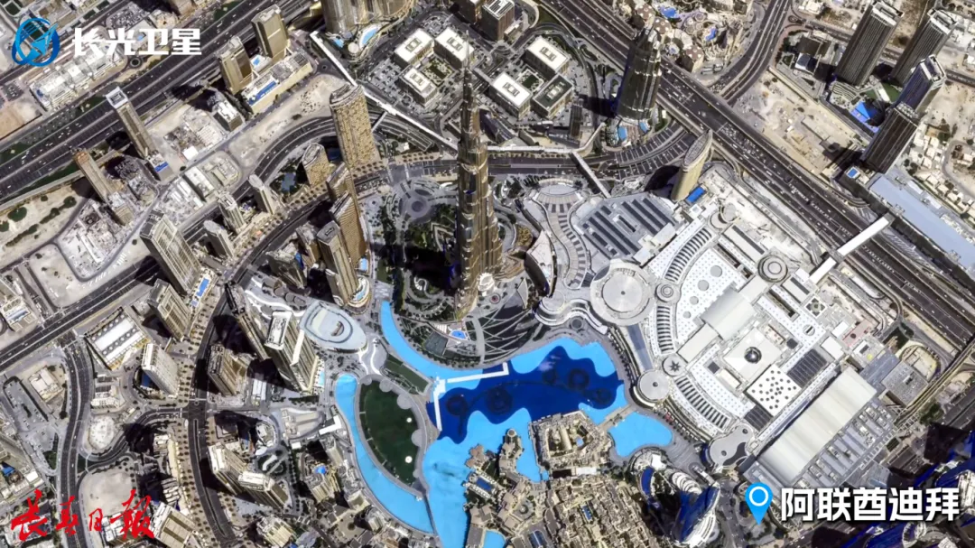
High-precision Jilin-1 3D stereo mapping product showing Dubai, United Arab Emirates
CGSTL has established a mature end-to-end system covering satellite design and manufacturing, in-orbit operation and control, and data applications. The company also has strong satellite mass-production capabilities and can provide customers with customized satellite manufacturing and related services, providing a solid industrial and technical foundation for the rapid deployment and stable operation of its stereo mapping satellite cluster.
Going forward, CGSTL plans to continue strengthening technological innovation while steadily expanding and optimizing the Jilin-1 stereo mapping satellite cluster. The company aims to further improve data acquisition timeliness and product accuracy, providing users across industries with more efficient and reliable space-based information services.
China’s expanding satellite manufacturing capacity and increasingly mature commercial space supply chain are bringing more Earth observation data, satellite platforms, payloads, and related space products to the global market at highly competitive prices. STARPATH GLOBAL connects international customers with these capabilities, helping source satellite imagery, 3D mapping data, customized satellites, payloads, and other space solutions based on specific project requirements and budgets. Contact STARPATH GLOBAL to discuss your project and explore suitable solutions from China.