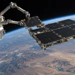
Russian Earth observation satellites are providing imagery to Iranian military forces to support targeting of U.S. and allied installations across the Middle East, according to defense intelligence assessments reported on September 17, 2026. The reported cooperation involves synthetic aperture radar and high-resolution optical imagery used to refine information on fixed military sites, air-defense positions and logistics infrastructure, adding a space-based intelligence layer to expanding security ties between Moscow and Tehran.
The reported data sharing would give Iranian forces access to reconnaissance capabilities beyond their own airborne, terrestrial and space-based surveillance assets. Satellite imagery can help identify changes at fixed installations, characterize infrastructure and support assessments before and after military operations.
The report did not identify the Russian satellites involved, disclose imagery resolution or revisit rates, or provide details on how quickly imagery moves from satellite collection through processing and delivery to Iranian users. Those factors are critical in determining whether an Earth observation system is supporting broad intelligence analysis, operational planning or time-sensitive targeting.
SAR and Optical Imagery Provide Complementary Intelligence
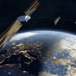
The reported architecture combines synthetic aperture radar with electro-optical imaging from satellites operating in low Earth orbit.
SAR satellites transmit microwave signals toward the surface and measure the reflected energy to construct images. Unlike optical cameras, radar does not depend on sunlight and can collect imagery through cloud cover, giving it particular value for persistent monitoring in regions where weather or darkness can limit conventional optical observations.
High-resolution optical satellites, meanwhile, generally provide imagery that is easier for analysts to interpret visually and can reveal detailed information about facilities, vehicles, construction activity and changes in site configuration when lighting and weather conditions permit.
Using the two sensor types together can therefore improve reconnaissance coverage. Optical imagery can provide detailed visual characterization, while SAR can maintain collection opportunities during nighttime or cloudy conditions.
Neither technology automatically provides continuous surveillance. Most LEO Earth observation satellites pass over a particular location only at defined intervals, with useful revisit rates depending on the number of spacecraft, orbital configuration, sensor field of regard and whether satellites can rapidly retask away from their ground tracks.
The operational value of the imagery also depends on the ground segment. Satellite tasking, downlink availability, image processing, interpretation and transmission to military users can introduce latency. As a result, descriptions of satellite imagery as providing “real-time” targeting data depend heavily on the specific constellation and communications architecture.
Imagery Can Support Target Refinement and Battle Damage Assessment
According to the report, imagery supplied to Iran has been used to support targeting information for fixed U.S. military bases, air-defense positions and logistics hubs across the Middle East. Satellite reconnaissance can also support post-strike battle damage assessment by comparing imagery collected before and after an attack.
For ballistic missile or long-range drone operations, accurate geolocation of fixed infrastructure can improve mission planning and allow operators to update their understanding of base layouts, aircraft dispersal areas, storage facilities and defensive deployments.
Satellite imagery alone, however, represents only one part of a targeting chain. Effective strike operations can also require intelligence fusion, coordinate validation, weapon navigation, mission planning and sufficiently recent information about the target.
That distinction is particularly important for mobile systems. Imaging a fixed runway, hangar or logistics facility is substantially different from locating and maintaining track of a mobile air-defense launcher or other relocatable target.
Military Use Highlights Dual-Use Nature of Earth Observation
The reported cooperation also illustrates the increasingly blurred boundary between civilian and military Earth observation.
Commercial satellite imagery is routinely used for agriculture, disaster response, infrastructure monitoring, environmental applications and mapping. The same characteristics that make those systems commercially valuable — improving spatial resolution, shorter revisit intervals and faster data delivery — can also make imagery useful for intelligence and defense applications.
This dual-use characteristic has become more significant as governments and military organizations gain access to imagery without operating every satellite themselves. Commercial providers, government-owned spacecraft and intelligence-sharing arrangements can all contribute data to a broader reconnaissance architecture.
For military planners, predictable satellite overflights create another operational consideration. Space surveillance networks can determine when foreign reconnaissance satellites are passing over sensitive facilities, allowing operators to adjust activities, increase camouflage or concealment, move mobile assets or employ deception measures.
Tracking an imaging satellite does not itself prevent collection, however. The effectiveness of countermeasures depends on the sensor involved, the target being observed and the wider communications and intelligence architecture supporting the reconnaissance system.
The September 17 assessments point to satellite-derived intelligence becoming a more integrated component of military cooperation between Russia and Iran. The operational significance will ultimately depend on factors not disclosed in the report, including which satellites are involved, how frequently they can revisit regional targets and how rapidly collected imagery reaches Iranian military users.