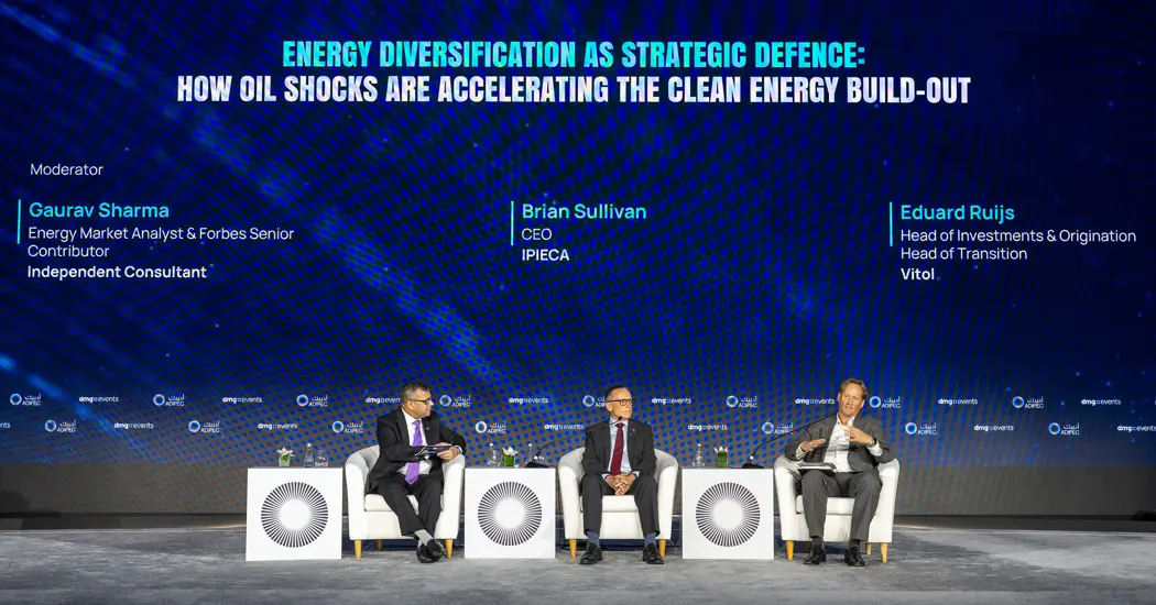
As governments and operators consider how to meet rising demand for reliable, affordable energy, Ipieca CEO Brian Sullivan used his ADIPEC 2026 article Energy Addition and Climate Realism: Governing Supply Growth, Resilience and Emissions to ask how that growth should be managed. Population growth, urbanization, industrial development, and digitalization are increasing demand. At the same time, geopolitical instability, supply-chain disruptions, and extreme weather are putting pressure on the infrastructure that delivers energy. Sullivan argued that new investment should address those pressures while bringing down emissions intensity.
Adding Energy Capacity Without Locking In Inefficiency
Sullivan used the term energy addition to describe a world that needs to build capacity across a wider range of sources and technologies. He warned that expansion without adequate planning can strain existing infrastructure, lock in inefficient assets, and undermine investor confidence. A project’s contribution to energy security depends on whether the surrounding infrastructure can support it and whether it can be delivered and operated at a cost customers can afford.
He pointed to the gap between national climate commitments and what was happening on the ground. In his article, Sullivan noted that by mid-2026, 139 countries had submitted national climate commitments for 2035, covering 88.1% of global emissions. He also cited a rise of about 0.4% in energy-related carbon dioxide emissions in 2025, to nearly 38.4 billion tonnes. In his view, long-term targets need to be backed by the conditions that let projects move ahead: clear policy, workable permitting, ready infrastructure, and investment.
Sullivan also argued that measures designed to improve resilience can help reduce emissions. Diversifying supply, strengthening grids, and improving efficiency can make energy systems better able to withstand disruptions. He put methane reduction in the same category of practical work. Operators can address many sources using existing knowledge and technology, and the benefits can come relatively quickly. Carbon management, electrification, and low-carbon fuels also have a role, though their deployment depends in part on whether infrastructure and policy are ready to support them.
What Methane Monitoring Can Help Operators Verify
Sullivan emphasized that companies cannot deliver those changes alone. Governments shape the rules and permitting pathways. Investors need confidence that projects can move from plans to execution. Communities need to see how development affects jobs, affordability, and local resilience. For operators, one way to make progress visible is to show what happened after an emission was detected: who investigated it, what action was taken, and what subsequent measurements showed.
Equipment-level monitoring already offers one way to collect that evidence. At ADIPEC 2026, PROTEGO presented valve sensor technology designed to track valve condition and emissions at storage and process facilities. A sensor installed on a valve can give maintenance teams information about that particular device. Across a portfolio of dispersed wells, storage sites, and processing facilities, satellite observations can serve a different purpose. Under suitable conditions, they can flag larger methane plumes and help teams decide where to investigate first.
From a Satellite Detection to a Verified Repair
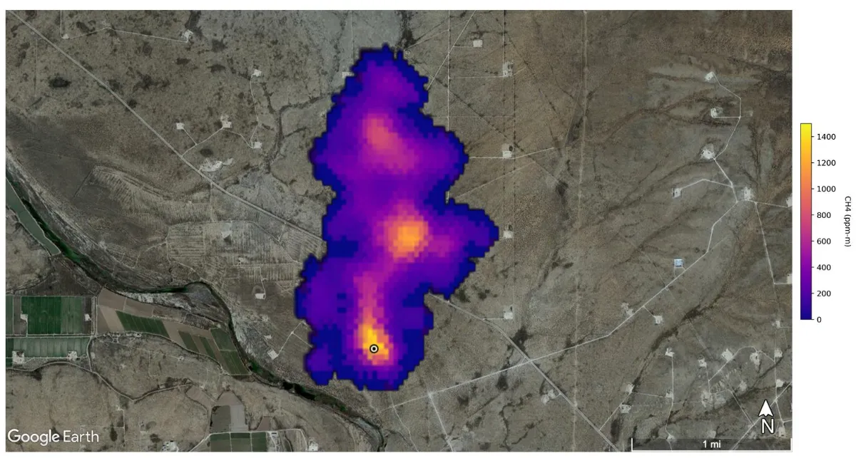
Image: An example of satellite-based methane monitoring from August 2022. NASA’s EMIT instrument detected this plume in the Permian Basin southeast of Carlsbad, New Mexico. Credit: NASA/JPL-Caltech.
Use the observation to narrow the search
A satellite detection gives an operator a location and time to investigate. If the plume appears near several wells or processing units, the first step is to compare the observation with asset maps, wind information, and operating records from the same period. A maintenance activity, equipment upset, or venting event may help explain what was observed. This initial review gives field teams a smaller set of possible sources to check. The UN Environment Programme’s Methane Alert and Response System uses satellite observations to notify operators and governments of very large emissions and support follow-up.
Confirm the source and record the action taken
A drone carrying a methane sensor can help narrow the search across a site. Close-range instruments can then help confirm which equipment is emitting. At a facility with fixed sensors, teams can also review readings around the time of the satellite pass to see whether the signal coincided with an operating change or had been present for longer. The work record should connect the original observation with the equipment identified, the likely cause, and the action taken.
Plan the follow-up before closing the case
After a repair or operating adjustment, a field recheck can test whether the source is still emitting under relevant operating conditions. A later satellite pass can provide a wider check when observation conditions are suitable. If no plume appears in that image, the operator should record it as a non-detection for that pass. Equipment-level measurements provide the evidence needed to verify the repair, especially for smaller or intermittent emissions.
For operators expanding production, that record also helps separate one-off events from recurring problems. If several alerts trace back to the same equipment type or operating condition, maintenance teams can check comparable assets elsewhere. That is how a single detection can inform a broader emissions reduction program as new capacity comes online.
Operators developing a monitoring program can contact STARPATH GLOBAL to define which assets to screen by satellite and where drone or on-site measurements are needed. STARPATH GLOBAL can help select observations around the size and distribution of potential sources and provide geolocated findings that teams can use to plan field checks and document follow-up.