
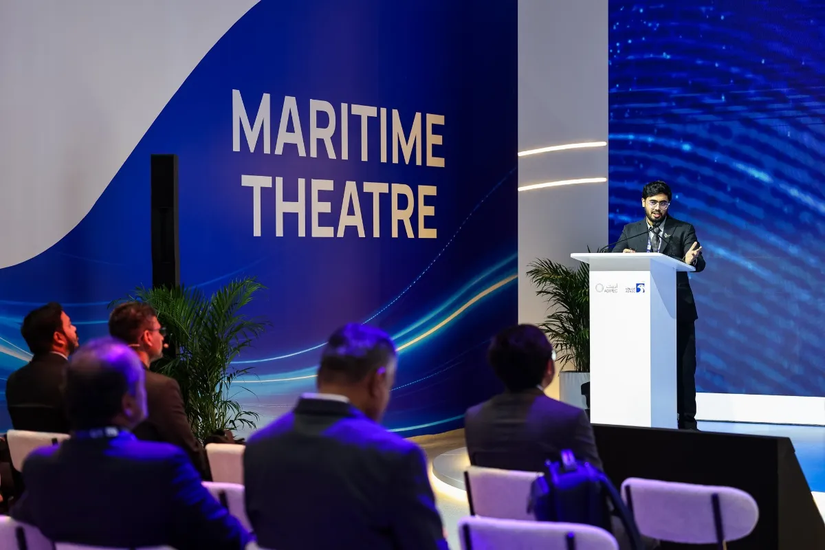
Taking place in Abu Dhabi from November 2 to 5, ADIPEC 2026 brings attention to the reliable operation of offshore platforms, subsea pipelines and export terminals. In its exhibition feature, Fugro extends the monitoring focus beyond infrastructure itself to the surrounding waters, where vessel activity, positioning reliability and changes in marine conditions can all influence operational risk.
In Protecting More Critical Energy Assets Through Impactful Maritime Awareness, Fugro identifies risks ranging from unauthorised vessel activity and anchor damage to environmental changes that could disrupt operations. For operators responsible for offshore platforms, pipelines, export terminals and coastal facilities, early threat identification depends on reliable positioning, accurate measurements and a clear understanding of activity around their assets.
The article describes how Maritime Security and Surveillance (MSS) brings these information sources together to help operators monitor their surroundings and identify changes requiring further investigation. The starting point is an accurate baseline of the asset and its operating environment. Repeated observations can then help distinguish meaningful changes from differences caused by measurement or data uncertainty.
Positioning reliability is another practical challenge. Fugro notes that interference with global navigation satellite systems (GNSS), including jamming and spoofing, is affecting the location information on which marine operations depend. Combining repeatable measurements with trusted geospatial data helps operators develop a clearer understanding of what is happening around their assets.
Environmental changes present a different category of risk. Harmful algal blooms, jellyfish and other marine growth can affect seawater intakes and cooling systems, potentially disrupting desalination plants and coastal power generation. For these facilities, conditions in the surrounding waters directly influence an essential operational resource, making environmental monitoring part of day-to-day asset management.
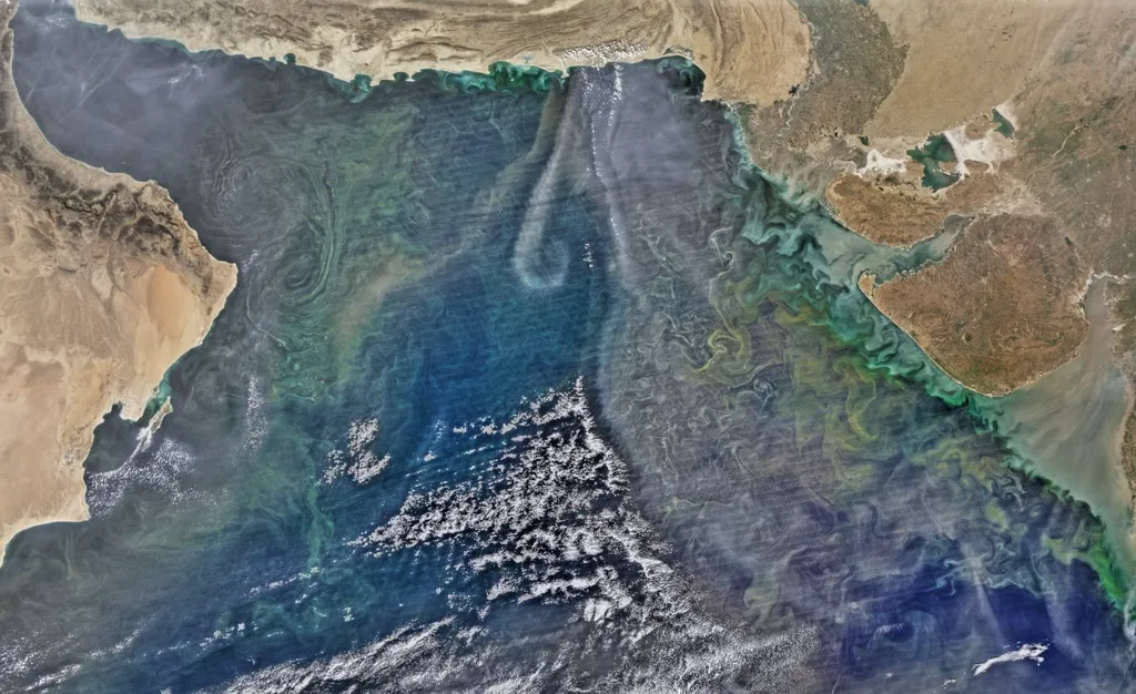
Image: A processed satellite view highlighting a phytoplankton bloom in the Arabian Sea, acquired on December 21, 2015. Credit: NASA’s Goddard Space Flight Center, Ocean Color Web and NASA’s Earth Observatory.
Activity near offshore infrastructure also requires continued attention. Unexpected vessel movements, anchors dragged near pipelines or changes in asset condition may warrant further assessment. Fugro emphasises that combining different sources of geospatial data helps operators establish where changes are occurring and understand their potential implications.
A Fugro spokesperson explains in the article that MSS goes beyond detecting activity: its purpose is to provide reliable information that helps operators understand what has changed around their assets and decide what to do next. By connecting measurement, monitoring, positioning and inspection, the approach builds a broader view of infrastructure and its operating environment.
Public technical information from Fugro’s SEAWATCH business also illustrates how environmental observations enter this process. Buoys and in-situ sensors provide local measurements, satellites add wide-area observations, and models are calibrated against site data. Results reach users through dashboards and alerts. Parameters include sea surface temperature, chlorophyll, suspended solids, turbidity and currents, demonstrating the complementary roles of broad-area observations and local measurements.
Together, these approaches raise a practical question for energy operators: when an anomaly develops beyond a facility boundary, upstream of an intake or in the waters surrounding a platform, how can teams detect it and determine where to investigate?
Extend Monitoring to the Waters Facilities Depend On
Monitoring boundaries should reflect the actual relationship between a facility and its marine environment. For coastal power plants and desalination facilities, priorities may include waters around seawater intakes and areas that could influence incoming water. For offshore platforms and export terminals, observation plans should consider asset locations, operating waters and nearby environmentally sensitive areas.
Satellites can provide broad-area information on sea surface temperature, ocean colour and suspected surface oil slicks, helping teams understand the location and extent of anomalies. Comparing observations over time with seasonal conditions can also help establish whether a change falls outside the area’s usual pattern.
If a turbid water plume appears near an intake, for example, operators need to understand its extent, its distance from the intake and how it changes over time. Satellite observations provide spatial context, while local sensors help confirm water quality at the intake itself. Together, these sources support inspection and sampling decisions.
Select Observation Methods According to the Anomaly
Different marine phenomena require different data. Sea surface temperature monitoring generally relies on suitable thermal infrared observations. Ocean colour, chlorophyll and turbidity can be assessed using multispectral imagery and validated retrieval methods. Assessing algal bloom risk also requires consideration of local water characteristics, historical conditions and field measurements.
Elevated chlorophyll or changes in water colour can provide a reason to investigate. Identifying the algae, determining toxicity and assessing potential operational effects still require sampling and analysis alongside local observations.
SAR satellite imagery can support screening for suspected oil spills. The European Maritime Safety Agency’s CleanSeaNet service analyses SAR images for possible marine oil pollution, together with meteorological, oceanographic and vessel information. Low-wind areas and certain natural phenomena can produce dark features resembling oil slicks, so findings need to retain their confidence levels and verification requirements.
In practice, observation plans should select sensors according to the phenomenon being investigated and clearly record acquisition times, usable coverage and interpretation conditions.
Connect Anomalies With Assets, Intakes and Sensitive Areas
A map of marine anomalies becomes operationally useful when its findings are connected to specific facilities.
Verification priorities can reflect an anomaly’s distance from intakes, platforms, terminals and sensitive shorelines, together with any corresponding changes recorded by local sensors. Assessing whether it could subsequently approach a facility requires current and wind information, appropriate modelling and specialist interpretation.
Following the detection of a suspected algal bloom, for example, a team can first review image quality and historical conditions before arranging sampling at relevant locations. A suspected oil slick may require site patrols, drone imagery or other observations to verify its nature and extent.
Verification results should return to the same event record, preserving the detection time, location, supporting observations, field findings and follow-up actions. Subsequent observations can then help establish whether the event is persisting, expanding, weakening or has ended.
Deliver Monitoring Results Around Operational Needs
A marine monitoring project can begin with a clearly defined requirement: understanding water changes near an intake, screening for suspected oil slicks around a platform or tracking environmental anomalies near a terminal. Scheduled observations and targeted verification can then be configured around the relevant risks.
Deliverables should be practical for operations teams, identifying the anomaly’s extent, observation time, associated facilities, supporting evidence and locations requiring further investigation. Areas needing long-term monitoring should gradually build a baseline and retain field verification results for future comparisons.
Through its marine remote sensing solutions, STARPATH GLOBAL combines multi-source satellite data and AI analysis to support sea condition assessment, marine water quality monitoring, red tide assessment and suspected oil spill monitoring. For waters surrounding energy infrastructure, projects can organise observations around platforms, terminals and seawater intakes, combining broad-area screening results with customers’ existing field monitoring data to support investigation, verification and continued tracking.
The reliable operation of offshore and coastal energy infrastructure is closely connected to changes in surrounding waters. Incorporating environmental observations into asset management helps operators obtain investigation leads before anomalies affect facilities and build a more complete assessment through field evidence.