
Author: starpathwp-production
-
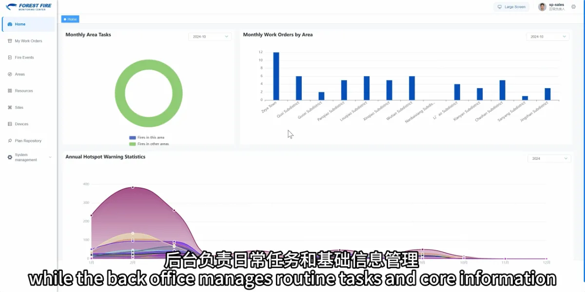
Can Forestry Staff Use a Wildfire Monitoring Platform Without Remote Sensing Expertise?
Yes. Forestry users mainly need to know how to review risk information, understand alerts, follow up on tasks and maintain operational records. Satellite data acquisition and processing are specialist activities. Everyday use focuses on applying the resulting information to fire management work. Ease of use depends on whether the platform clearly presents the information staff…
-
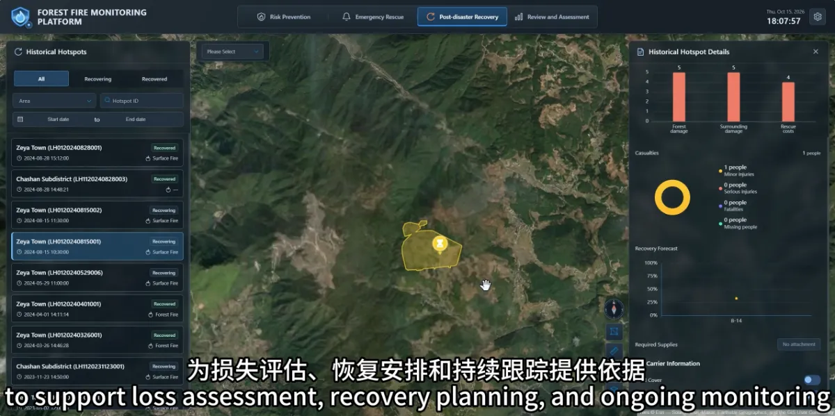
How Can the Monitoring Platform Help After a Wildfire Has Been Extinguished?
After a fire is extinguished, the platform can still support damage information management, recovery tracking and incident review. Linking these activities to the original incident helps managers follow subsequent work and learn from the response. For forestry organisations, extinguishing the fire changes the focus of the work: from active response to damage verification, recovery planning…
-
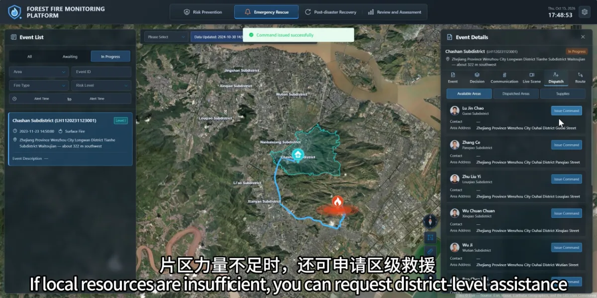
How Can the Platform Help Coordinate People and Supplies After a Wildfire Is Confirmed?
The platform brings together the fire location, area responsibilities, nearby teams and resource information, helping commanders understand what support may be available. After locating a fire, teams need to establish who should respond, which resources are required and how additional assistance can be coordinated. When this information is spread across phone records, paper lists and…
-
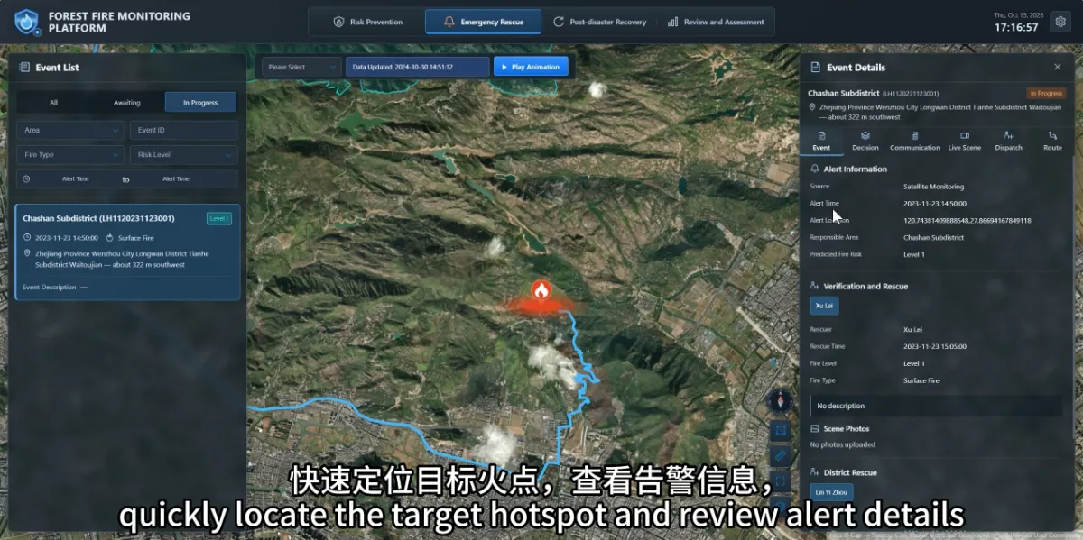
What Should Duty Staff Do First After Receiving a Satellite Wildfire Alert?
Start by checking the alert’s location, time and responsible management area, then arrange verification under established fire management procedures. A satellite alert identifies a suspected anomaly that still needs to be assessed alongside field conditions. An alert becomes useful when it reaches the right people promptly and its verification results and subsequent actions remain traceable.…
-
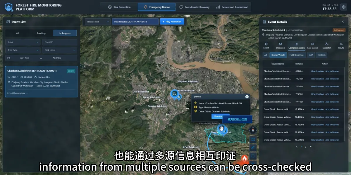
How Can Teams Verify a Potential Wildfire When Clouds or Fog Affect Satellite Observations?
When clouds or fog affect satellite observations, teams can use ground cameras, drones and field reports to continue verification. Information from different sources helps fill gaps that may arise when relying on a single observation method. For forestry staff, the practical questions are: What reliable information is currently available? What remains unknown? How can the…
-
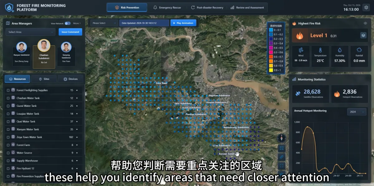
How Can a Wildfire Monitoring Platform Help Before a Fire Starts?
A wildfire monitoring platform can help managers identify areas that need closer attention and review whether people and resources are ready. Its role begins during routine prevention work, before a fire occurs. Forest managers face practical questions every day: Where should patrols be strengthened? Which areas need closer observation? If an anomaly appears, which teams,…
-
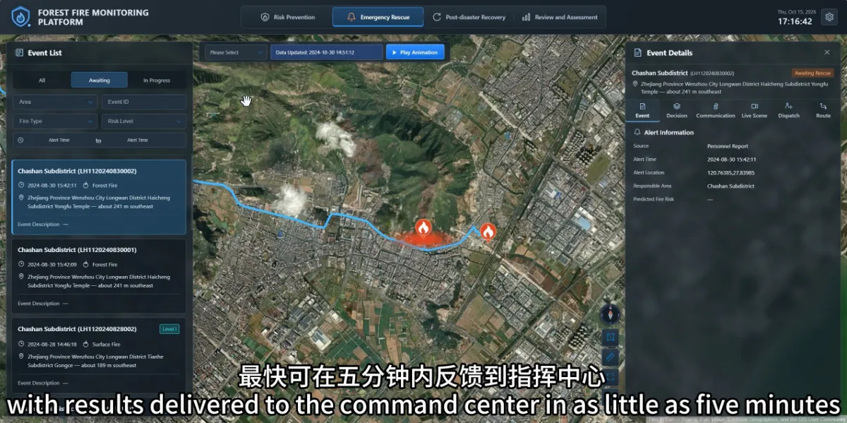
How Quickly Can Satellites Detect Wildfires? Does an Always-Online Platform Mean Real-Time Monitoring?
Wildfire detection speed depends on satellite observation timing, data availability and processing time. A platform that operates around the clock does not mean satellites continuously observe every part of a forest, or that every fire will trigger an alert within a fixed period. Understanding these different timings helps forestry teams plan duty coverage and assess…
-
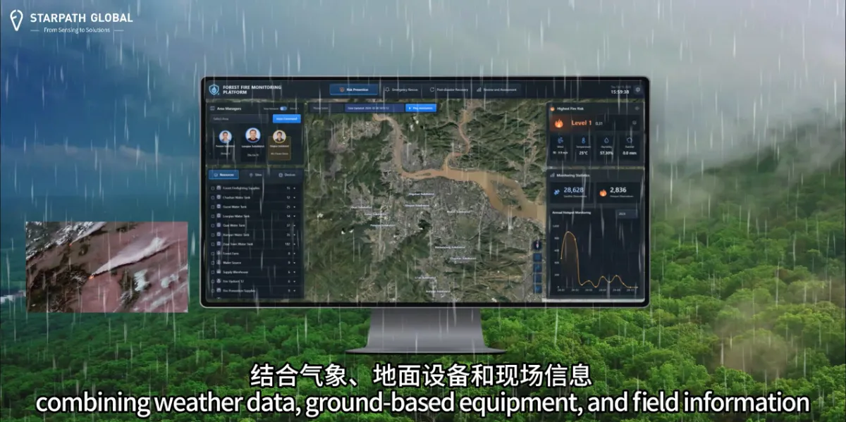
Why Do We Need Satellite Wildfire Monitoring If We Already Have Forest Rangers and Cameras?
Satellite monitoring helps forestry teams cover larger areas and focus patrols and ground monitoring where they are needed most. Across extensive forests and complex terrain, an additional way to identify unusual activity provides another opportunity to investigate potential fires sooner. Forest rangers understand local conditions and can assess situations on site. Cameras provide ongoing observation…
-

FCC Clears Amazon’s $11.5 Billion Globalstar Acquisition, Opening Path to Satellite Phone Service
Amazon Leo is Amazon’s low Earth orbit satellite network, formerly known internally as Project Kuiper before the company adopted the permanent brand name in November 2025. The system is designed to deliver high-speed, low-latency broadband internet and data services to residential, business, and government customers in areas where terrestrial networks are limited, unreliable, or nonexistent.…
-
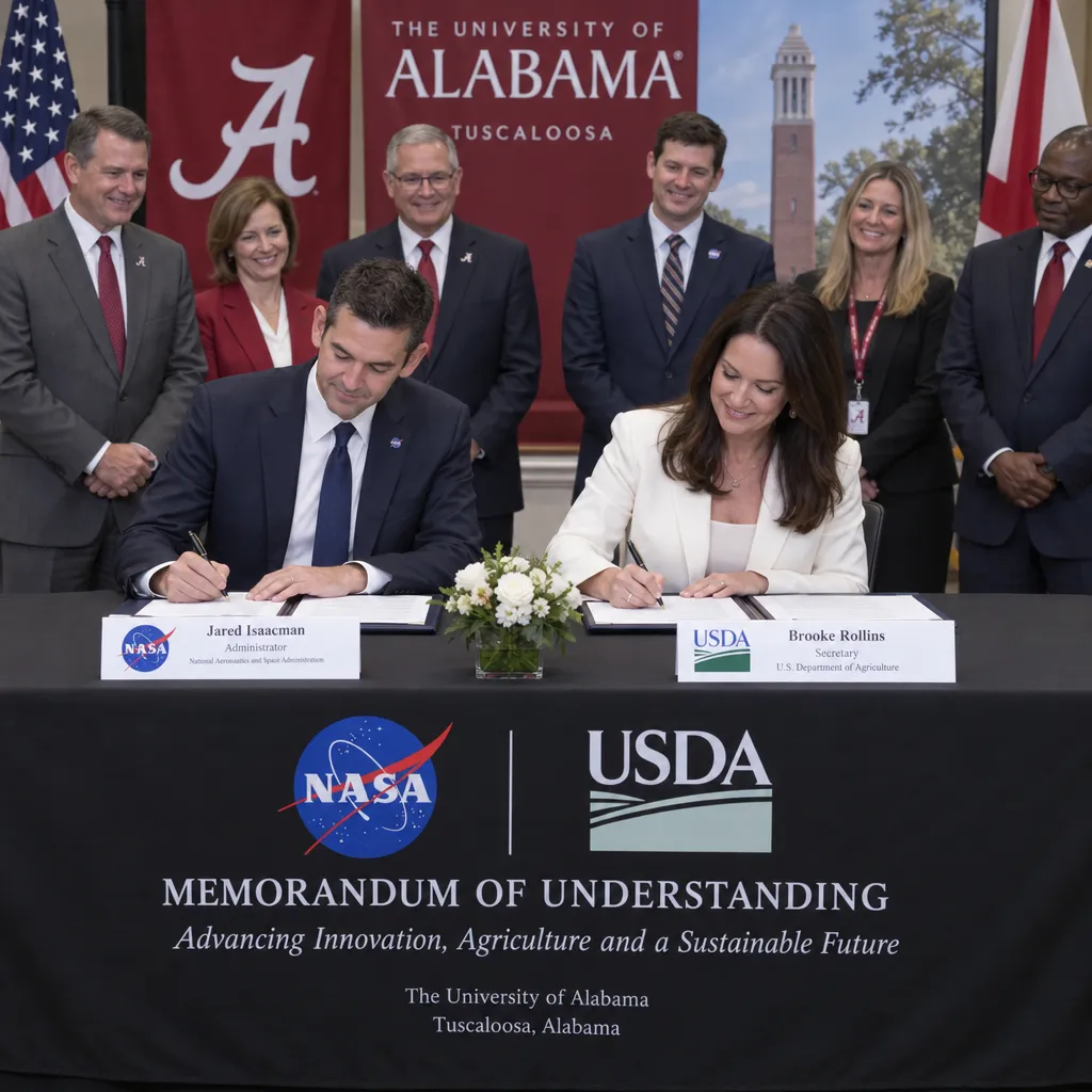
NASA and USDA Sign Agreement to Expand Satellite Data for American Farmers
NASA Administrator Jared Isaacman and Secretary of Agriculture Brooke Rollins signed the MoU at the University of Alabama in Tuscaloosa, the latest stop on NASA’s Inspiration Tour. The deal builds on an existing partnership between the two agencies across several areas of remote sensing and data work. Under the agreement, the agencies will work together…