
A satellite image can look sharp and still be unsuitable for your project. A cloud may cover the only facility you need to inspect, a missing-data strip may cross your pipeline corridor, or a visually convincing colour image may lack the spectral measurements required for analysis.
Satellite imagery quality control should answer two questions: does the delivery meet the agreed specifications, and is it usable for the intended task? Checking those separately helps customers distinguish a compliant product from one that needs clarification, additional processing or replacement.
The following workflow focuses on optical satellite imagery delivered for mapping, monitoring and multispectral analysis. SAR products require additional checks specific to radar acquisition and processing.
1. Start with the Order Specifications
Before opening the imagery, retrieve the agreed area of interest (AOI), acquisition window, product specification and acceptance conditions. Without these, you can identify potential problems but cannot reliably determine whether the delivery meets the order.
Confirm which requirements apply to the entire AOI and which apply to critical assets. A regional land-cover project and an inspection of a single pipeline crossing may need very different acceptance criteria.
- Coverage: the exact AOI version, required buffers and any locations that must remain unobstructed.
- Timing: permitted acquisition dates, relevant event timing and whether multiple dates are allowed.
- Product: sensor, required bands, native resolution, delivered pixel size and processing level.
- Quality: cloud and shadow definitions, positional accuracy, image-to-image registration and any task-specific limits.
- Supporting files: metadata, quality masks, processing reports and source-scene information.
Processing-level names differ between suppliers. Ask what corrections have actually been applied rather than assuming that a label such as “Level 2” has the same meaning for every product.
2. Use a Delivery Acceptance Checklist
Run automated checks across the complete delivery where possible, then inspect representative areas and every critical asset manually. The checklist below provides a starting point; its acceptance limits must come from the project requirements and contract.
3. Check Valid Coverage, Not Just the Image Footprint
A scene footprint shows where an image is expected to extend. It does not establish that every location contains usable observations. An apparently complete rectangular raster may include NoData borders, internal gaps or invalid pixels in individual bands.
Overlay the agreed AOI and inspect the intersection of valid pixels across the bands your analysis requires. Check internal holes, tile edges, narrow corridor sections and critical facilities. Use the documented NoData values and masks; a dark pixel is not automatically missing data.
Report geometric coverage separately from usable coverage. A location can contain valid recorded pixels yet remain unusable because of cloud, shadow, saturation or insufficient detail. When reporting percentages, state the denominator and avoid counting overlapping defects twice.
For mosaics, verify the acquisition date of each contributing scene. The delivery date and processing date are not acquisition dates. A visually seamless mosaic may combine observations from different days, which can matter when checking construction, flood extent or crop conditions.
4. Evaluate Clouds Inside the AOI
Scene-level cloud percentage is a useful search filter, but it does not describe visibility at your target. A mostly clear scene can have its only cloud directly over a pumping station. Conversely, a cloudy scene may contain a clear AOI.
Calculate cloud and shadow coverage within the agreed AOI, then inspect critical assets individually. Keep the contractual cloud metric separate from a broader assessment of usability: haze, terrain shadows and cloud shadows may affect the task even when they are excluded from the supplier’s stated cloud percentage.
Read Quality Layers Correctly
Quality layers can encode fill pixels, clouds, cloud shadows, saturation and other conditions. Some are categorical maps; others store multiple flags within the bits of an integer. Decode the delivered product’s documented schema rather than copying mask logic from another sensor or processing collection.
For example, Landsat Collection 2 provides QA_PIXEL and QA_RADSAT layers. Landsat 8–9 surface reflectance products also include aerosol quality information. These layers support screening, but their presence does not establish that every unflagged pixel is suitable for analysis.
Compare the Mask with the Actual Imagery
Inspect natural-colour and relevant false-colour views alongside the mask. Review cloud edges, thin cloud, hazy areas, bright roofs, sand, snow and dark shadows. USGS identifies optically thin clouds and bright surfaces among the challenges for its CFMask algorithm.
A 2017 study in Remote Sensing of Environment evaluated cloud and cloud-shadow algorithms against manually derived reference masks, including a validation dataset of 96 Landsat 8 scenes. It assessed both missed clouds and incorrectly flagged clear areas. That distinction matters operationally: missed clouds can contaminate analysis, while false cloud flags remove usable observations.
If you revise a mask manually, retain the supplied version and save the changes separately. Record who made the changes, why they were needed and which areas remain uncertain.
5. Verify Position and Cross-Date Alignment Separately
Absolute positional accuracy concerns where features fall relative to their ground coordinates. Image-to-image registration concerns how well corresponding features align between acquisitions. Two images can align with each other while sharing a displacement from the correct ground position.
First confirm the coordinate reference system, datum, units and transformation settings. Then compare identifiable, stable ground features with surveyed points or reference data whose accuracy and provenance are documented. A convenient web basemap can reveal a suspicious offset, but it is not automatically an accuracy reference.
Distribute check points across the AOI, including edges, different elevations and mosaic seams. Avoid relying on roof corners, moving shadows or water edges as ground references. If a correction is applied, test it with independent points that were not used to calculate that correction.
For change detection, measure local alignment between dates and compare the remaining uncertainty with the size of the changes you need to detect. Review sun and viewing angles as well: different shadows and building lean can produce apparent changes even when ground features align.
For a detailed diagnostic workflow, see Why Don’t Satellite Images Line Up with Your GIS Data?
6. Check Whether Pixel Values Support the Analysis
A successful RGB display only confirms that software can render an image. It does not prove that its values are calibrated, its bands are correctly identified or its processing is appropriate for quantitative work.
- Confirm the measurements: distinguish digital numbers, radiance, top-of-atmosphere reflectance and surface reflectance.
- Apply the documented scaling: check scale factors, additive offsets, units and invalid-value rules before calculating indices.
- Inspect each required band: review saturation, unexpected constant values, striping, missing lines and band-to-band displacement.
- Check spatial detail: examine representative targets for blur, processing artifacts and excessive sharpening at native pixel scale.
- Test the intended workflow: inspect representative vegetation indices, classifications or change outputs before approving the dataset for routine use.
Landsat Collection 2 surface reflectance provides a useful example: its stored values use a scale factor of 0.0000275 and an additive offset of −0.2. Calculating NDVI directly from those stored integers does not generally give the same result as calculating it from correctly scaled reflectance, because the additive offset affects the ratio.
Also distinguish native multispectral measurements from pansharpened or colour-balanced products. A display-oriented RGB delivery cannot supply a missing near-infrared band. For fusion-specific checks, see Can You Use Pansharpened Imagery for NDVI and Land Cover Classification?
These customer checks screen for suitability and obvious defects. They do not replace a formal sensor calibration or comprehensive radiometric validation.
7. Recognize What a Preview Can Hide
Landsat 7 provides a documented public example of why coverage and appearance need separate checks. Its Scan Line Corrector failed on May 31, 2003, leaving gaps in subsequent acquisitions. The remaining observations retained their geometric and radiometric corrections, but the missing areas still had to be considered when selecting data for a particular AOI.
A gap-filled version introduces another question: where did the replacement pixels come from? Filling a gap with another acquisition can improve coverage while changing the observation date locally. An apparently continuous image therefore needs source-date information before it can represent conditions at a specific time.
This example concerns public Landsat data, not a STARPATH GLOBAL delivery case. The general lesson applies to customer review: inspect the full-resolution data, masks and provenance together rather than accepting the thumbnail as evidence of completeness.
8. Record an Explicit Acceptance Decision
Keep the decision tied to a named task, dataset version and set of evidence. The following records are illustrative examples, not measured delivery results or recommended universal thresholds.
Accept
Example record: “Accepted for regional land-cover mapping. Required bands and acquisition dates match the order. Valid AOI coverage and measured positional errors meet the agreed criteria. Cloud-mask review and representative classification checks found no unresolved issues affecting the intended use.”
Accept with Restrictions
Example record: “Approved for visual review of the unobstructed corridor sections shown in the attached mask. A cloud shadow obscures the identified crossing, which must be excluded from automated change analysis. Additional imagery is required to complete the crossing assessment.”
Operational permission to use part of a delivery should be distinguished from formal contractual acceptance. Record any agreed exception and its consequences explicitly.
Request Clarification and Hold Acceptance
Example record: “Acceptance pending. The files open correctly, but the reflectance scale and offset are undocumented, and the mosaic lacks source-date footprints. Please provide the radiometric specification and acquisition provenance before quantitative analysis proceeds.”
If a confirmed defect breaches an agreed requirement, document it and request the contractual remedy, such as corrected processing, replacement files or additional acquisition. Do not label an unresolved failure as an accepted restriction without agreement.
Every record should include the order and scene IDs, AOI version, reviewer, review date, methods, measured results, annotated defect locations and required follow-up. Preserve the original delivery alongside any corrected versions.
Choose Imagery Around the Decision You Need to Make
Useful acceptance criteria begin with the business task: which assets must be visible, what changes must be detectable, and which measurements must remain reliable? Those answers guide the required bands, resolution, timing, processing and validation effort.
STARPATH GLOBAL’s satellite imagery services cover data sourcing, processing, quality control and delivery. To define a suitable product and review process, discuss your requirements with our team, including your AOI, critical targets and intended analysis. We can help select a resolution and processing approach that fit the task and budget.
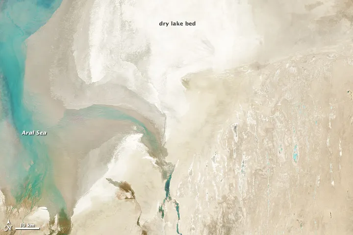
Top image: Natural-colour Landsat 8 imagery of the Aral Sea, acquired on March 24, 2013. Thin cirrus clouds that are difficult to distinguish in this view become apparent in the corresponding cirrus-band image. Credit: NASA Earth Observatory image by Robert Simmon, using USGS and NASA data.