
Tag: Change Detection
-

ADIPEC 2026: What Makes a Satellite Monitoring Pilot Ready to Scale?
At ADIPEC 2026 in Abu Dhabi, Weatherford President and CEO Girish K. Saligram said some oilfield service tasks that once required four to eight people are now performed autonomously. Siemens President and CEO Roland Busch argued that extending such gains across industrial operations requires companies to rethink how work gets done. In a separate panel,…
-
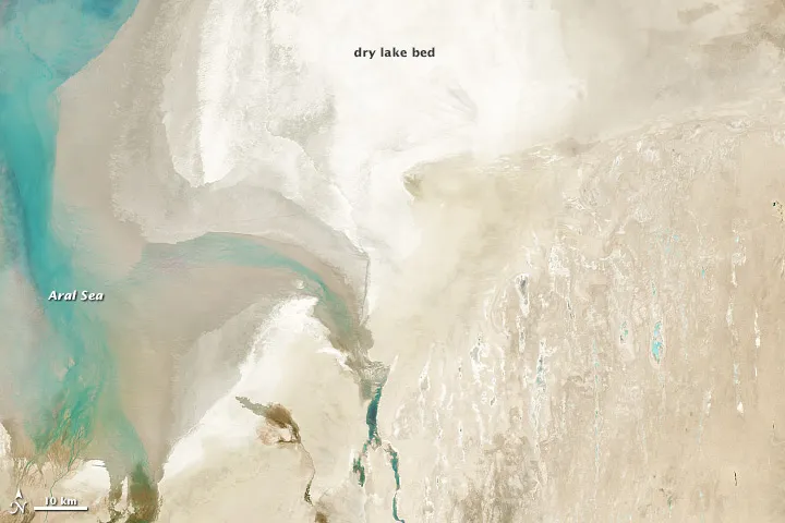
How to Check Satellite Imagery Quality Before Accepting Delivery
A satellite image can look sharp and still be unsuitable for your project. A cloud may cover the only facility you need to inspect, a missing-data strip may cross your pipeline corridor, or a visually convincing colour image may lack the spectral measurements required for analysis. Satellite imagery quality control should answer two questions: does…
-
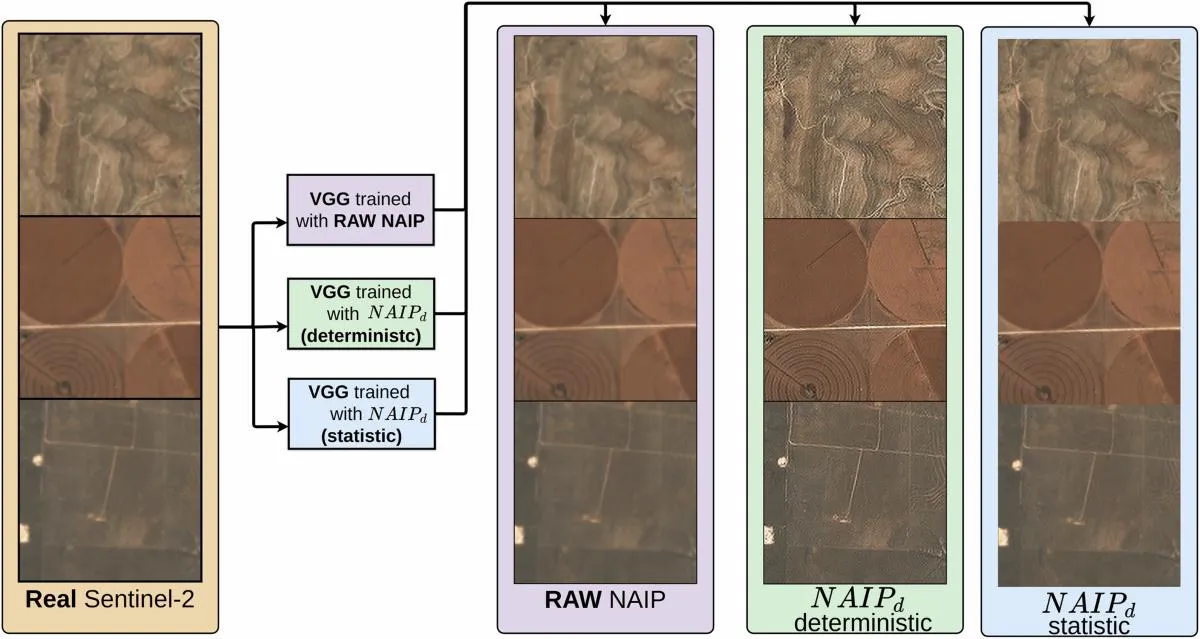
Can AI Super-Resolution Replace High-Resolution Satellite Imagery?
AI super-resolution can make satellite imagery look sharper and, in some validated workflows, improve the information extracted from it. But it does not automatically turn a low-resolution observation into the equivalent of a native high-resolution image. Whether it can replace a new imagery purchase depends on the task: a background map, a land-cover classification, a…
-
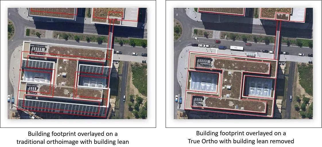
Why Don’t Satellite Images Line Up with Your GIS Data?
A new satellite image arrives, but roads sit slightly beside their mapped centerlines, building roofs extend beyond existing footprints, and a utility corridor appears to have shifted. Before moving any GIS features, check how both datasets were positioned. A sharper or newer image does not automatically provide a more accurate ground reference. Misalignment can come…
-
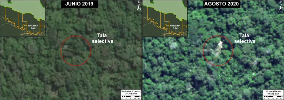
Can Satellite Imagery Detect Selective Logging?
Satellite imagery can detect some selective logging, particularly when tree removal creates visible canopy gaps, new access routes or repeated changes in the radar signal. However, detecting a large clear-cut is a different task from identifying scattered tree removal beneath a mostly intact canopy. The reliability of the result depends on the disturbance footprint, forest…
-
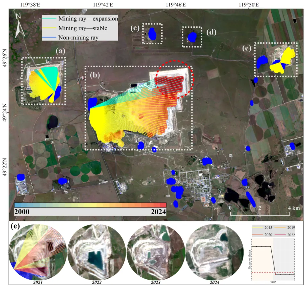
How to Monitor Mining Expansion Using Multi-Temporal Satellite Imagery
Multi-temporal satellite imagery can reveal where a mine’s surface footprint is expanding, which facilities are changing, and how surrounding land is being affected. Reliable monitoring, however, requires more than placing two images side by side. The images must be comparable, the changes must be linked to specific mine features, and the findings must be checked…
-
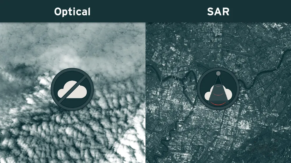
Why Satellite Monitoring Fails Under Cloud Cover — and When SAR Helps
A satellite may pass over a mine, port or infrastructure corridor on schedule and still produce no usable optical view of the site. Clouds can hide the ground, while cloud shadows and haze can make visible areas unsuitable for reliable analysis. Synthetic aperture radar (SAR) can maintain observations through cloud cover and darkness, but it…
-
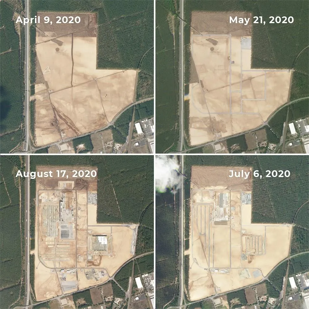
Can Satellite Imagery Detect Early-Stage Construction?
Satellite imagery can reveal construction activity before a building is completed—and sometimes before its structure appears. Land clearing, exposed soil and expanding work areas can provide early signals. But reliably identifying a small foundation or building extension requires much finer imagery than detecting a large construction site. The result depends on the size of the…
-
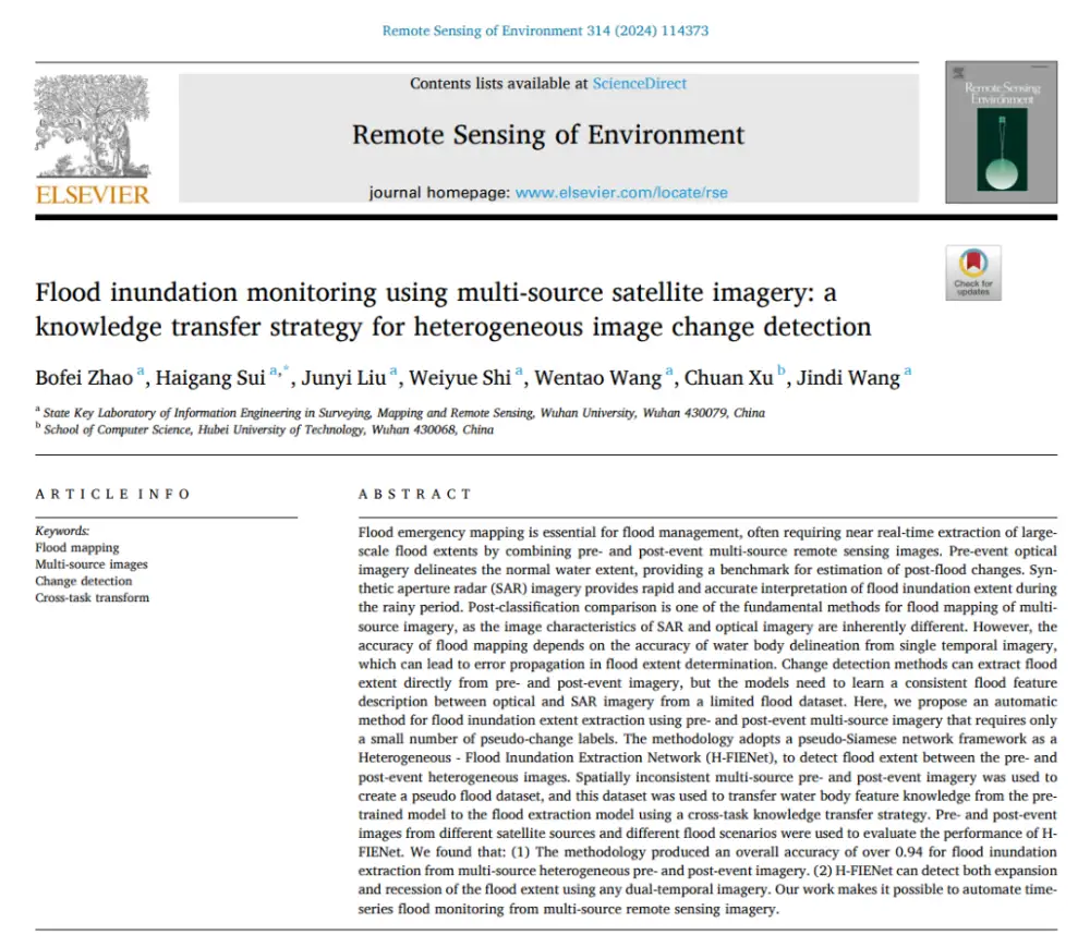
How AI Detects Flood Changes Across Optical and SAR Images With Few Training Pairs
In brief: Instead of separately mapping water in pre- and post-flood images and then overlaying the results, the method first maps water features from optical and SAR imagery into a more consistent semantic space, then directly identifies where water conditions have changed. More importantly, it does not require large numbers of real flood-change labels: it…