
Author: starpathwp-zyj
-
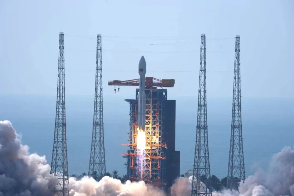
Long March 8A Launches 28th Group of Low-Earth-Orbit Internet Satellites (Video)
A Long March 8A carrier rocket lifted off from the Hainan Commercial Space Launch Site at 10:03 a.m. Beijing Time on Oct. 25, 2026, placing China’s 28th group of low-Earth-orbit internet satellites into their designated orbit. The mission continued the country’s accelerated satellite-internet deployment campaign. The spacecraft were developed by the China Academy of Space…
-
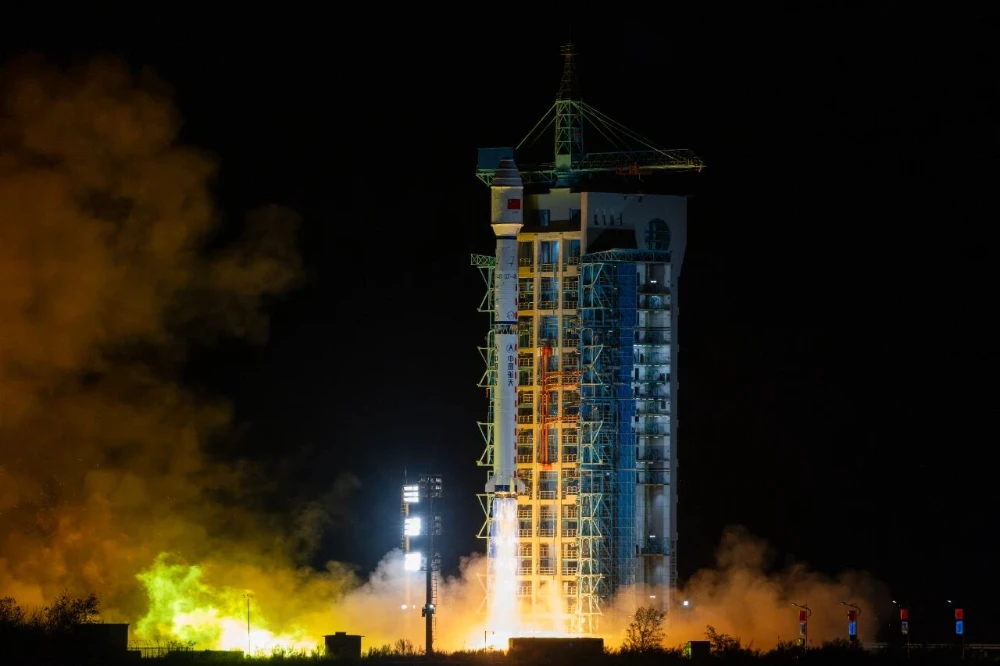
Long March 4B Launches Yaogan-53 Satellites 07–09 and Yaogan-56 Satellites 19–21
China launched six remote-sensing satellites aboard a Long March 4B rocket from the Jiuquan Satellite Launch Center at 3:25 a.m. Beijing Time on October 24, 2026. The rocket placed Yaogan-53 satellites 07, 08 and 09 and Yaogan-56 satellites 19, 20 and 21 into their planned orbits. The payload comprised two separately designated groups of three…
-
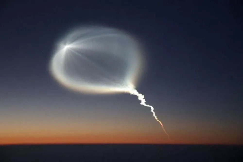
China Launches Yaogan-50 03 Remote-Sensing Satellite on Long March 6A (Video)
China launched the Yaogan-50 03 remote-sensing satellite aboard a Long March 6A rocket from the Taiyuan Satellite Launch Center at 6:15 p.m. Beijing Time on Oct. 23, 2026. The spacecraft entered its planned orbit, completing the 672nd launch of China’s Long March rocket family. Chinese authorities said Yaogan-50 03 will primarily support land surveys, crop…
-
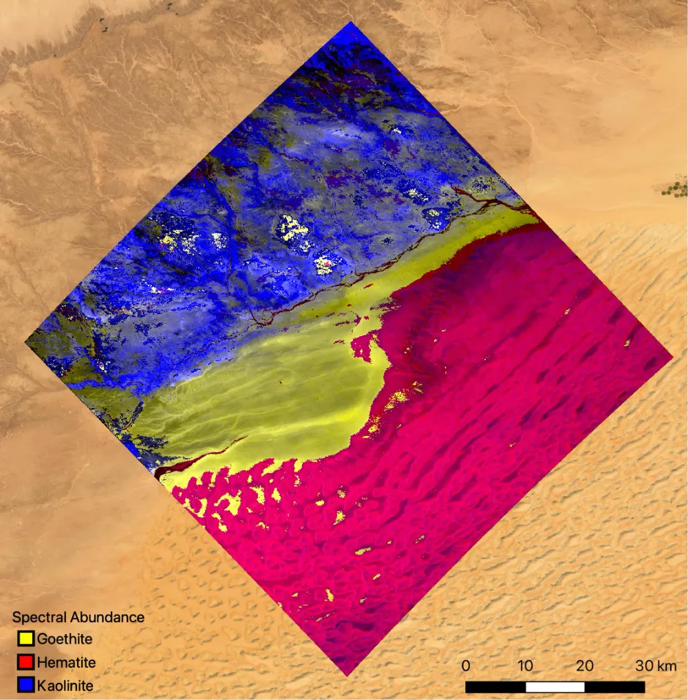
Hyperspectral Satellites: The Race Beyond More Bands
Two satellite systems observe the same open-pit mine and offer different answers. The multispectral satellite says: “This area appears reddish. Iron oxides may be present.” It infers material properties from differences across a handful of broad spectral bands. The hyperspectral satellite can go further: “The spectral signatures indicate hematite and goethite, with an associated alteration…
-
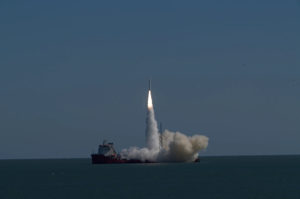
China’s Ceres-1S Launches First Wuyang Constellation Satellite From Sea (Video)
China launched the first satellite of its domestically developed Wuyang low-inclination remote-sensing constellation at 11:39 a.m. Beijing time on Oct. 21, 2026. The spacecraft, Xiguang-4 01, lifted off aboard a Ceres-1S Y8 rocket from a mobile platform in the Yellow Sea off Rizhao, Shandong province, and entered a 541-kilometer low Earth orbit. The mission marks…
-
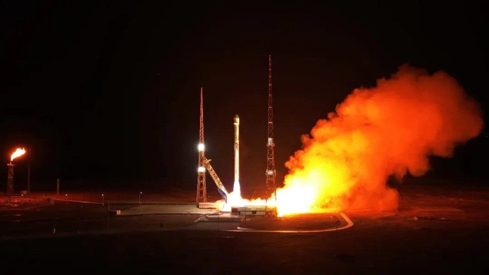
Zhuque 2E Launches 10 Satellites on Zhuque 2 Series’ 10th Flight (Video)
LandSpace launched its Zhuque-2E Y4 rocket from the Dongfeng Commercial Space Innovation Pilot Zone at the Jiuquan Satellite Launch Center at 11:40 UTC on October 14, 2026, deploying 10 satellites into their planned orbits. The rideshare mission carried eight ADA Space computing satellites and two laser data-transmission test satellites, marking the 10th flight of the…
-
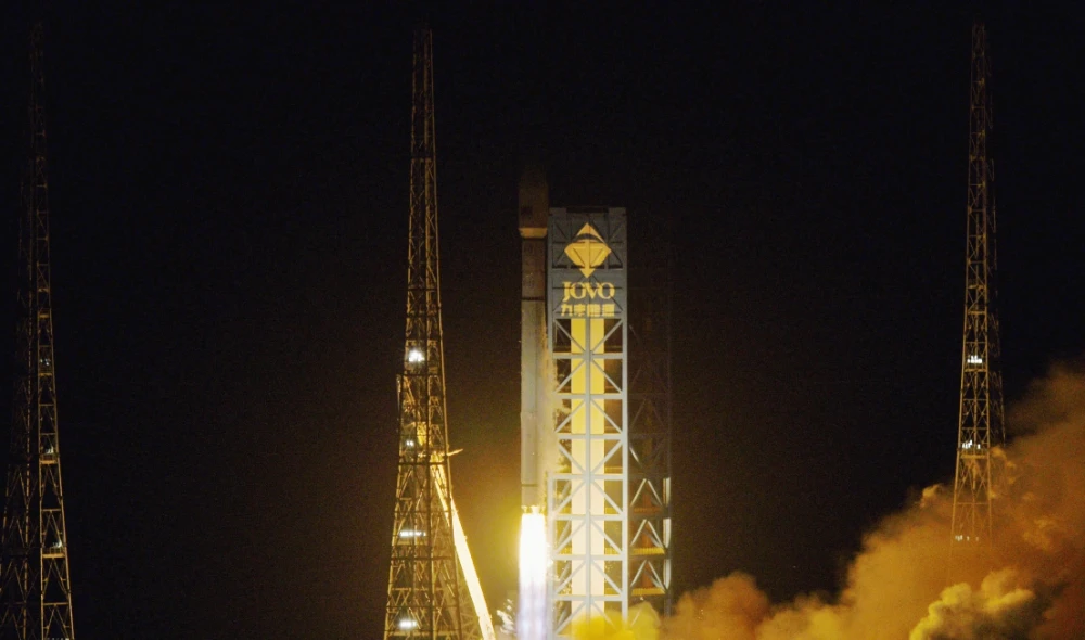
Long March 12 Launches China’s 27th LEO Internet Satellite Group
At 3:27 a.m. on October 10, 2026, China successfully launched the 27th group of low-Earth orbit internet satellites aboard a Long March 12 carrier rocket from the Hainan Commercial Space Launch Site. The satellites entered their designated orbit, continuing the phased deployment of China’s satellite internet system and marking the 671st mission of the Long…
-

China’s Satellite Internet System Enables First Arctic-to-Antarctic Video Call
China used its domestically developed GW satellite internet system to complete its first real-time video call spanning the Arctic and Antarctica on September 25 during the country’s 16th Arctic Ocean scientific expedition. The call connected the research vessels Xuelong, Jidi and Tansuo-3 with China’s Qinling Station in Antarctica, with reported video delay of no more…
-
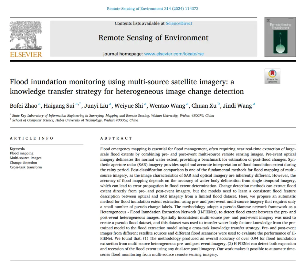
How AI Detects Flood Changes Across Optical and SAR Images With Few Training Pairs
In brief: Instead of separately mapping water in pre- and post-flood images and then overlaying the results, the method first maps water features from optical and SAR imagery into a more consistent semantic space, then directly identifies where water conditions have changed. More importantly, it does not require large numbers of real flood-change labels: it…
-
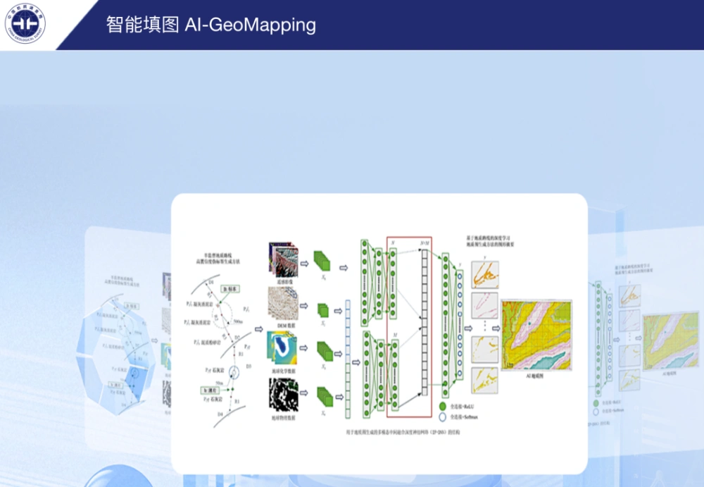
China’s AI-GeoMapping System Guides 400-Square-Kilometer Gobi Survey
China’s AI-GeoMapping system has guided 400 square kilometers of 1:50,000-scale regional geological mapping in northern Alxa, Inner Mongolia, where fused remote-sensing, aeromagnetic and geochemical data helped field teams identify concealed intrusions, faults beneath sediment cover and new mineral-prospecting clues. The Hohhot Natural Resources Comprehensive Survey Center of the China Geological Survey reported on Sept. 24…