
FAQs
-
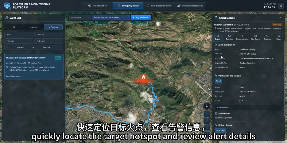
What Should Duty Staff Do First After Receiving a Satellite Wildfire Alert?
Read more →: What Should Duty Staff Do First After Receiving a Satellite Wildfire Alert?Start by checking the alert’s location, time and responsible management area, then arrange verification under established fire management…
-
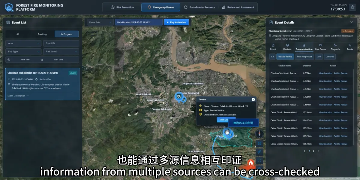
How Can Teams Verify a Potential Wildfire When Clouds or Fog Affect Satellite Observations?
Read more →: How Can Teams Verify a Potential Wildfire When Clouds or Fog Affect Satellite Observations?When clouds or fog affect satellite observations, teams can use ground cameras, drones and field reports to continue…
-
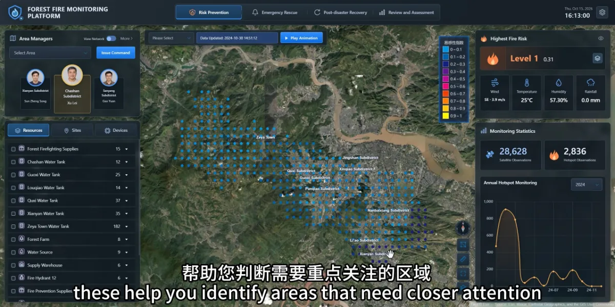
How Can a Wildfire Monitoring Platform Help Before a Fire Starts?
Read more →: How Can a Wildfire Monitoring Platform Help Before a Fire Starts?A wildfire monitoring platform can help managers identify areas that need closer attention and review whether people and…
-
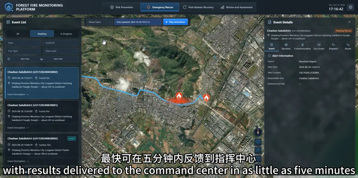
How Quickly Can Satellites Detect Wildfires? Does an Always-Online Platform Mean Real-Time Monitoring?
Read more →: How Quickly Can Satellites Detect Wildfires? Does an Always-Online Platform Mean Real-Time Monitoring?Wildfire detection speed depends on satellite observation timing, data availability and processing time. A platform that operates around…
-
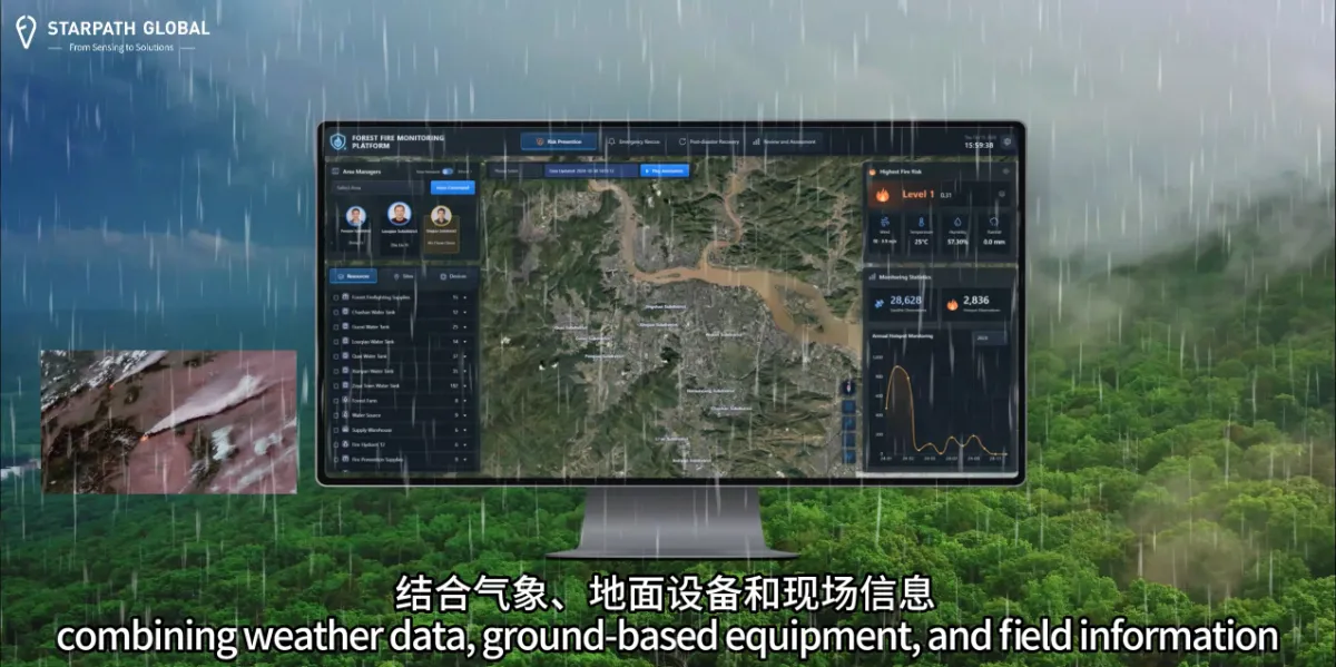
Why Do We Need Satellite Wildfire Monitoring If We Already Have Forest Rangers and Cameras?
Read more →: Why Do We Need Satellite Wildfire Monitoring If We Already Have Forest Rangers and Cameras?Satellite monitoring helps forestry teams cover larger areas and focus patrols and ground monitoring where they are needed…
-
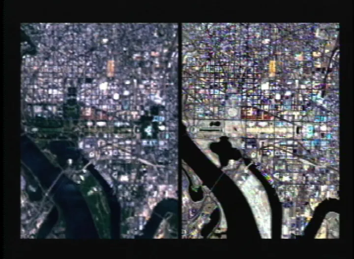
Can You Use Pansharpened Imagery for NDVI and Land Cover Classification?
Read more →: Can You Use Pansharpened Imagery for NDVI and Land Cover Classification?Yes, pansharpened imagery can be used for land cover classification and, under suitable conditions, NDVI analysis. Whether it…
-
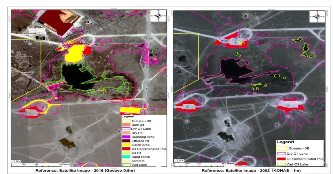
Can Satellite Imagery Detect Oil Spills on Land?
Read more →: Can Satellite Imagery Detect Oil Spills on Land?Satellite imagery can help identify some oil spills on land, particularly where contamination is exposed, sufficiently extensive, and…
-
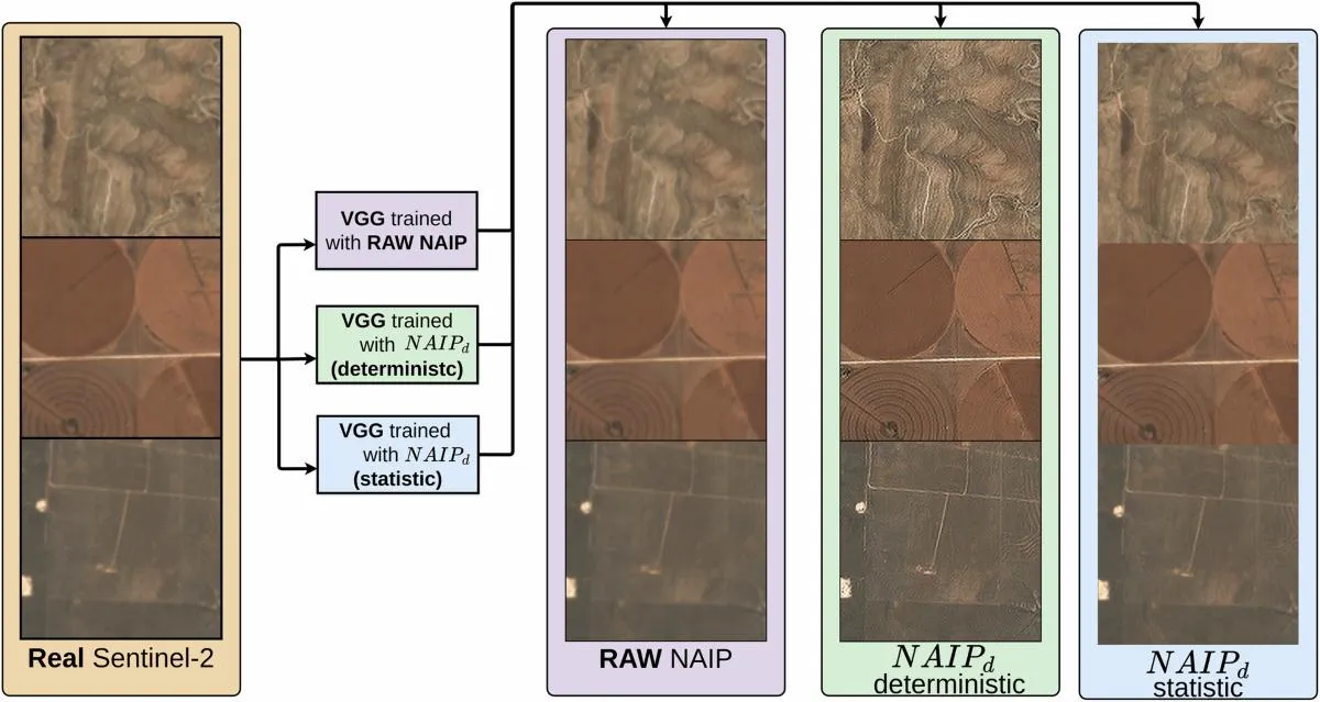
Can AI Super-Resolution Replace High-Resolution Satellite Imagery?
Read more →: Can AI Super-Resolution Replace High-Resolution Satellite Imagery?AI super-resolution can make satellite imagery look sharper and, in some validated workflows, improve the information extracted from…
-
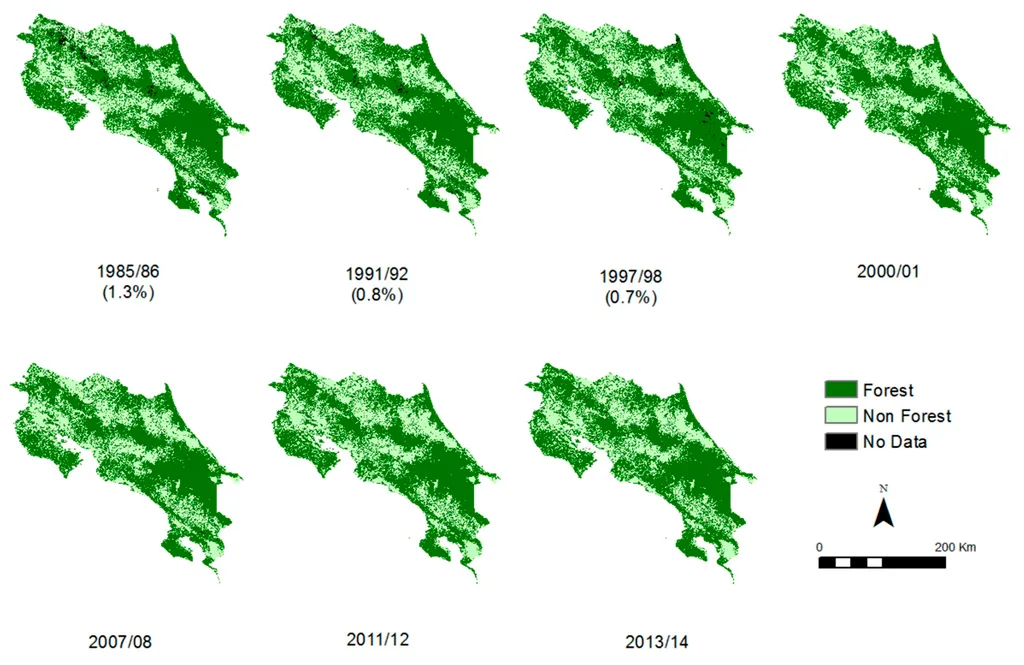
How to Check Historical Tree Cover Before Planting
Read more →: How to Check Historical Tree Cover Before PlantingChecking whether trees existed on a plot before planting requires more than searching a forest-loss map. A useful…
-
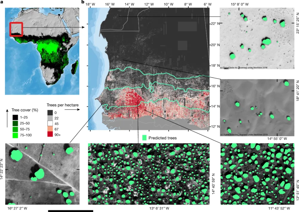
Can Satellite Imagery Count Individual Trees?
Read more →: Can Satellite Imagery Count Individual Trees?Satellite imagery can support individual tree counting when crowns are large enough, sufficiently separated and clearly visible. It…
-
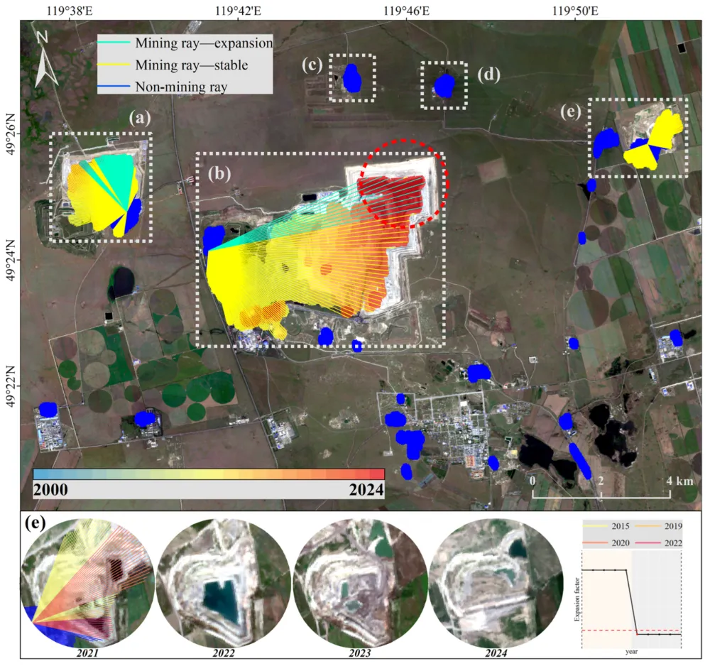
How to Monitor Mining Expansion Using Multi-Temporal Satellite Imagery
Read more →: How to Monitor Mining Expansion Using Multi-Temporal Satellite ImageryMulti-temporal satellite imagery can reveal where a mine’s surface footprint is expanding, which facilities are changing, and how…
-
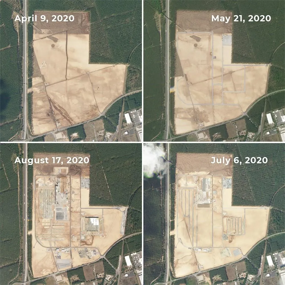
Can Satellite Imagery Detect Early-Stage Construction?
Read more →: Can Satellite Imagery Detect Early-Stage Construction?Satellite imagery can reveal construction activity before a building is completed—and sometimes before its structure appears. Land clearing,…