Extreme weather events are increasingly recognized as material drivers of operational and financial risk across multiple industries. Rather than isolated disruptions, hazards such as floods, heatwaves, droughts, and infrastructure stress events can interact with cascading or compound effects in certain regions and contexts.
Extreme Weather as an Emerging Systemic Risk
Climate-related hazards are increasingly studied as systemic risks due to their potential to affect interconnected infrastructure, supply chains, and economic systems. In some regions, overlapping or sequential extreme events (e.g., heat followed by drought, or heavy rainfall following saturated soil conditions) can amplify operational impacts. However, the frequency and severity of compound events vary significantly by geography and time period, and remain an active area of climate research.
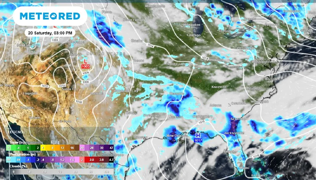
Recent reporting by major news organizations, including NBC News, has highlighted multiple flood and flash flood events in the United States in recent years. These events have contributed to localized disruptions in transportation infrastructure, emergency response capacity, and urban services in affected areas. Such impacts are typically region-specific rather than nationally uniform.

The grounds crew brings out the tarp at Kauffman Stadium in Kansas City, Missouri, where fans were advised to seek shelter as severe weather, June 13, 2026, delays the game between the Royals and the Houston Astros. Denny Medley/IMAGN IMAGES via Reuters Connect
In Europe, analyses from the European Centre for Medium-Range Weather Forecasts (ECMWF) and the Copernicus Climate Change Service have documented atmospheric circulation patterns such as summer blocking highs. These patterns can be associated with persistent high-pressure systems that contribute to prolonged heat events in Western and Central Europe. While such configurations are well understood meteorologically, their occurrence varies seasonally and cannot be attributed to single deterministic causes in individual events.
Note: Attribution of specific heatwaves or blocking configurations depends on the time window, dataset, and model framework used. The statements above describe general atmospheric patterns rather than individual event attribution.
Limitations of Traditional Environmental Risk Monitoring
Conventional environmental monitoring systems rely on a combination of ground-based sensors, administrative reporting systems, and observational networks. These systems remain essential for high-accuracy local measurements but may face limitations in spatial coverage, cross-border consistency, and reporting latency during rapidly evolving extreme weather conditions.
As climate-related hazards increasingly affect larger geographic areas and multiple systems simultaneously, there is growing interest in complementary data sources that provide wide-area, consistent, and frequently updated environmental observations.
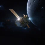
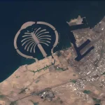
Satellite-based Earth observation is one such complementary approach. It enables systematic monitoring of land, water, and atmospheric conditions at regional to global scales, supporting both retrospective analysis and near-real-time situational awareness.
How Satellite Data Supports Climate Risk Intelligence
Modern geospatial analytics systems integrate multiple types of satellite-derived data, each contributing to different aspects of environmental and operational risk assessment:
- Optical imagery: Land cover change detection, flood extent mapping, crop condition monitoring, and infrastructure impact assessment (when cloud conditions permit).
- Synthetic Aperture Radar (SAR): All-weather, day-and-night surface imaging used in flood mapping, storm impact assessment, and surface deformation detection.
- Thermal infrared imagery: Surface temperature analysis, urban heat island effects, wildfire risk indicators, and drought-related thermal anomalies.
- Vegetation indices (e.g., NDVI): Indicators of vegetation health, crop stress, and agricultural productivity variability.
- InSAR (Interferometric SAR): Detection of millimeter-scale ground deformation used in infrastructure monitoring, subsidence tracking, and geotechnical risk assessment.
When combined, these datasets can provide a multi-layered perspective on environmental conditions. However, their effectiveness depends on integration with domain expertise, validation data, and appropriate modeling frameworks.
Flood Monitoring and Emergency Response
Flood monitoring is one of the most established applications of satellite-based Earth observation. SAR technology is particularly important in flood conditions because it can operate through cloud cover and independently of daylight, enabling observation during severe weather when optical imagery is limited.
Operational systems such as the Copernicus Emergency Management Service (CEMS) provide satellite-based mapping and situational awareness to support disaster response and damage assessment in affected regions. These services are widely used by emergency management agencies and humanitarian organizations.
Agriculture, Insurance, and Environmental Exposure
Satellite-derived vegetation indicators such as NDVI are widely used in agricultural monitoring applications, including crop condition assessment, drought detection, and yield estimation models. These indicators are often combined with meteorological and ground-based data to improve accuracy.
In some agricultural insurance frameworks, remotely sensed indices are incorporated into index-based insurance products. These applications support faster assessment of regional agricultural conditions, although model performance can vary depending on crop type, region, and calibration data quality.
Infrastructure, Mining, and Supply Chain Visibility
InSAR-based monitoring enables detection of small-scale ground deformation and is used in geotechnical and infrastructure risk assessment, including subsidence monitoring, mining site stability, and tailings facility surveillance.
In logistics and maritime contexts, satellite imagery is sometimes combined with complementary datasets such as AIS vessel tracking and trade flow information to improve visibility of port activity, congestion, and regional transport disruptions. These applications are growing but are not yet uniformly adopted across all supply chain systems.
From Observation to Decision Support
The value of satellite data is not limited to observation alone. Its impact is significantly enhanced when integrated into analytics platforms, statistical models, and machine learning systems that translate raw observations into decision-support outputs.
In this context, geospatial data functions as one component of broader environmental and operational risk analysis systems used in climate-sensitive industries.
How Satellite Data Supports Climate Risk Intelligence
Organizations such as STARPATH GLOBAL work with multi-source Earth observation data, including optical imagery, SAR, and environmental indices, to support analytical workflows in sectors such as agriculture, mining, infrastructure monitoring, insurance, and logistics.
These applications may include flood exposure mapping, crop stress monitoring, infrastructure condition assessment, and disruption risk analysis. Such systems are typically designed to complement, rather than replace, ground-based monitoring and domain-specific operational data.
By integrating satellite-derived observations with analytics workflows, organizations can improve situational awareness and support more proactive, data-informed risk management strategies.
Explore Satellite-Driven Climate Intelligence Solutions
Access remote sensing capabilities for flood monitoring, storm impact assessment, agricultural risk analytics, and infrastructure resilience evaluation. Learn how satellite data supports real-time decision-making across climate-sensitive industries. Explore application overview →
References
- NBC News – Weather and flood reporting: https://www.nbcnews.com/weather
- Copernicus Emergency Management Service (CEMS): https://emergency.copernicus.eu/
- Copernicus Global Flood Monitoring: https://global-flood.emergency.copernicus.eu/
- NOAA Climate and Extreme Weather Research: https://www.noaa.gov/
- ECMWF Climate and Forecast Systems: https://www.ecmwf.int/