The delivery timeline for custom satellite data is determined by a combination of orbital scheduling constraints, sensor availability, environmental conditions, and post-processing requirements. Unlike static datasets, satellite tasking is dependent on real-time acquisition opportunities, making timing highly variable across different missions and use cases.
The first factor influencing delivery time is satellite revisit cycle. Each satellite follows a fixed orbital path, meaning it can only observe a specific location at certain intervals. Depending on satellite constellation density and geographic latitude, revisit frequency can range from multiple times per day to once every several days. This directly impacts how quickly a target area can be captured.
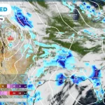
Environmental conditions also play a significant role, particularly for optical imaging systems. Cloud cover, atmospheric haze, and lighting conditions may prevent successful image acquisition, requiring additional scheduling attempts. In contrast, SAR systems are less affected by weather conditions, but still depend on orbital alignment and tasking availability.
Once a successful acquisition occurs, data is transmitted to ground stations for processing. This stage includes radiometric calibration, geometric correction, noise reduction, and orthorectification. For more advanced applications, additional processing such as mosaicking, temporal stacking, or analytical product generation may be required.
Quality assurance is performed to ensure spatial accuracy, consistency, and usability. Any artifacts or distortions are identified and corrected before final delivery. Depending on the complexity of the dataset, this stage can vary in duration.
As a result, total delivery time is not a fixed value but a dynamic outcome of multiple system components working together. In urgent scenarios, high-priority tasking can significantly reduce acquisition time, especially when multiple satellites are available. Standard requests may require longer scheduling windows, particularly when targeting specific geographic regions or narrow time constraints.
Ultimately, delivery timelines represent a balance between orbital physics, environmental constraints, and data processing workflows, all of which are optimized to provide accurate and reliable geospatial intelligence.