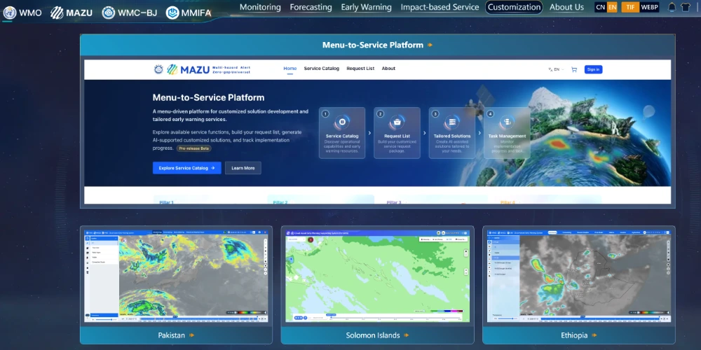
China is expanding an artificial-intelligence-based weather early-warning solution to developing countries, combining satellite observations, radar, buoy measurements and numerical weather models to deliver localized forecasts and alerts even where computing and communications infrastructure remain limited.
Known as MAZU, the system was developed by the China Meteorological Administration to support global disaster-risk reduction and the United Nations’ “Early Warnings for All” initiative. It was introduced internationally at the 2025 World Artificial Intelligence Conference and upgraded in April 2026.

Exhibition on China’s MAZU intelligent meteorological early-warning solution. (Photo courtesy of the Shanghai Meteorological Service)
From weather data to actionable warnings
MAZU is designed as an integrated “monitoring–forecasting–warning–service” system. Its cloud platform currently supports more than 200 meteorological products across 30 categories, expanding beyond conventional weather forecasts to impact-based forecasting.
The platform integrates data from China’s Fengyun meteorological satellites with artificial-intelligence forecasting models known as Fenglei, Fengqing, Fengshun and Fengyu. These models are intended to help transform large volumes of raw observations into higher-resolution forecast products and operational guidance.
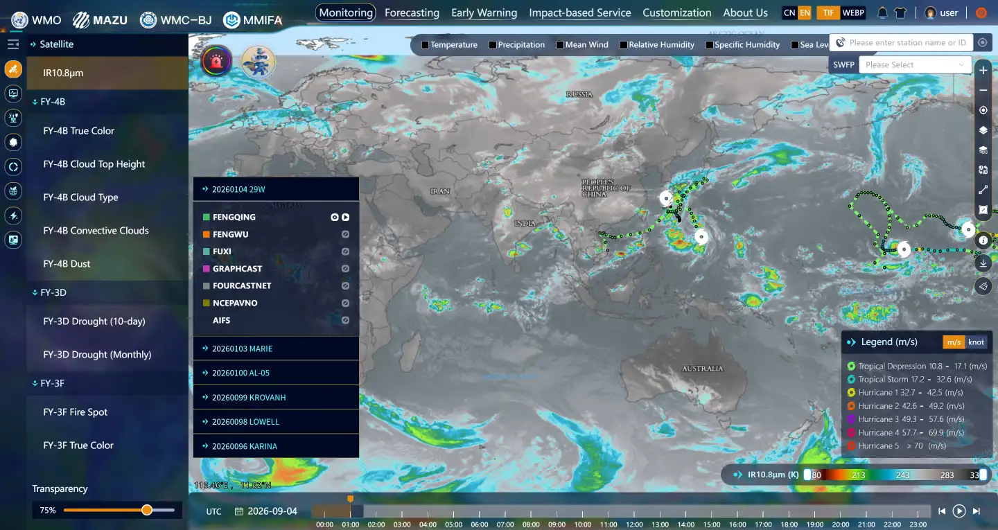
The system can process satellite, radar and buoy data within minutes. In areas without reliable terrestrial networks, warning messages can also be transmitted through short-burst satellite communications to mobile phones or dedicated receiving terminals.
This architecture addresses a common problem in international meteorological cooperation: receiving satellite data does not automatically provide the computing capacity, local models or trained personnel required to convert those data into timely public warnings.
Djibouti upgrade adds local sensing and edge computing
Djibouti became the first African country to receive a MAZU deployment. In July 2025, the China Meteorological Administration provided the country with a city-level, multi-hazard early-warning toolkit.
MAZU Djibouti 2.0 was unveiled in July 2026 at a meteorological session of the World Artificial Intelligence Conference in Shanghai. The upgraded system adds local observation capabilities and autonomous warning functions to the original forecasting platform.

On-site delivery of MAZU Djibouti 2.0. (Photo courtesy of the China Meteorological Administration)
Djibouti’s location at the entrance to the Red Sea makes its port infrastructure vulnerable to strong winds and rough seas. The country also faces limitations in network connectivity and local forecasting capacity. The upgraded system embeds a forecasting processor directly into terminal equipment, reducing dependence on continuous cloud connectivity.
According to the report, the system improves spatial resolution from 9 kilometers to 3 kilometers and can issue graded warnings for extreme weather up to 24 hours in advance. The resulting “monitor–forecast–warn” package can be deployed at ports, towns and fishing communities, effectively placing a compact forecasting capability close to the users who need it.
From an engineering perspective, this edge-computing approach can improve resilience by reducing data-transfer requirements and allowing essential processing to continue during connectivity interruptions. It also shifts part of the system’s complexity from centralized infrastructure to field terminals, making hardware reliability, power availability, software updates and local maintenance important factors in long-term deployment.
Adapting the system to local languages and hazards
MAZU’s Fengyun satellite AI toolkit is intended for countries that can access satellite observations but lack the infrastructure to use them operationally. By deploying AI models at the application terminal, the toolkit can combine satellite data with local observations through edge processing.
In Mongolia, the system uses Fengyun satellite snow-cover data to produce Mongolian-language safety guidance for herders before severe winter storms. In Pakistan, a China-Pakistan early-warning system has been incorporated into the Pakistan Meteorological Department’s operational platform. The system reportedly issued an advance warning before a period of heavy rainfall, supporting evacuation preparations.
In Ethiopia, Chinese teams have provided both the system and hands-on training for local forecasters. The approach is structured as a configurable toolkit rather than a fixed, one-size-fits-all product: countries can select modules for rainfall, tropical cyclones, temperature or other hazards according to their local requirements.
That modularity is important because early-warning systems depend on more than forecast accuracy. Alerts must also be understandable, delivered through available communications channels and connected to emergency procedures that local authorities can execute.
Training and the operational chain
The China Meteorological Administration has supported the technical deployment with international training, scholarships and visiting-researcher programs. Since 2024, nearly 1,000 trainees from more than 100 developing countries and regions have participated in China’s meteorological early-warning training programs.
In August 2026, officials and experts from eight countries, including Mozambique, Kenya and Sri Lanka, attended an international workshop in China focused on building early-warning capabilities. China also plans to include meteorological AI training in its broader foreign-assistance training framework.
The operational value of such programs lies in closing the gap between prediction and response. Fujian Province, a region frequently affected by typhoons and heavy rainfall, has contributed several elements to the MAZU toolkit. Its “Fujian OTS” intelligent forecasting technology uses three core algorithms to select forecasting approaches for complex terrain and changing weather conditions.
During China’s 14th Five-Year Plan period, Fujian’s intelligent gridded forecasts reached 1-kilometer spatial resolution, with selected areas refined to the hundred-meter level. The province’s 24-hour typhoon-track forecast error was reduced to less than 50 kilometers in 2025, according to the report. The technology has since been adopted in more than 20 provincial-level regions and is being adapted for overseas precipitation and temperature forecasting.
Fujian’s “1262” escalating meteorological service mechanism is also included as an operational reference. It calls for preparations 12 hours before an event, implementation of response measures six hours beforehand and the start of evacuations two hours before the expected impact.
Matching satellite capacity to operational needs
The experience of MAZU also points to a broader lesson for organizations building satellite-enabled services: effective deployment depends on selecting the right data, payload and technical configuration for each operational requirement.
China’s expanding commercial space sector is bringing more satellite manufacturing capacity to the global market, creating increasingly competitive options for international customers seeking satellite imagery, payloads and related capabilities. STARPATH GLOBAL’s satellite imagery helps customers access this growing supply and select products suited to their actual business needs.
For Earth-observation applications, the highest-resolution imagery is not always necessary. STARPATH GLOBAL can recommend an appropriate resolution based on the customer’s specific industry and use case, helping control costs while ensuring that the imagery remains sufficient for operational decisions.
If your organization is exploring satellite remote sensing but lacks the relevant technical experience, you can apply to join STARPATH GLOBAL’s Pioneer Partner Program. Through its Forward Deployed Engineers initiative, the team works with prospective users to identify practical applications and assess how satellite data can generate measurable operational value.