Satellogic, a leading provider of high-resolution satellite imagery to governments and commercial customers worldwide, is innovating access to best space-based data with its cutting-edge technologies. The company is a publicly-traded company listed on Nasdaq Stock Exchange (SATL). They delivering high-quality geospatial data at the best price-point, enabling better decisions at scale and across industries. Satellogic is democratizing access to critical geospatial data to drive better global decision-making. Their wide range of space data services and broad space coverage through satellite constellations, makes them a pioneer of efficient space data providers.
Satellogic’s satellite engineers, operators, and supporting teams are on a mission to deliver a fundamentally better picture of the planet and the many forces that reshape it every day. They are committed to improving the quality, access, and affordability of Earth Observation data for global sustainability, security, and equity.
Earth Observation
Satellogic is driving Earth Observation data adoption to improve global outcomes. Actionable insights from Earth Observation (EO) are essential for addressing global challenges, including food, water, and energy supply, national security and defense, climate change and natural disasters, as well as global health and humanitarian crises.
Earth Observation data is derived from high-resolution satellite images taken from orbit. Satellogic’s proprietary multispectral cameras, paired with its constellation’s frequency, enable organizations to track daily changes on the Earth’s surface with sub-meter resolutions. By driving down the costs of building and maintaining a commercial satellite constellation it is possible to unlock use cases across a broad range of industrial, environmental, and government applications:
- Energy & Mining
- Government & Defense
- Finance & Insurance
- Environment & Climate
Products
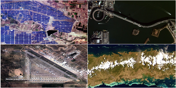
Satellogic makes high-quality space-based data more accessible, enabling governments and enterprises to make informed decisions on the ground. Its sub-meter resolution imagery ensures clarity and accuracy, with up to seven daily revisits and frequent remaps of key locations. Data is easily accessible via API, FTP, and a reseller network, offering cost-efficient solutions compared to other satellite and non-satellite alternatives. With scalable collection capacity and global coverage, Satellogic® can capture any area or point of interest worldwide.
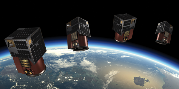
Space Systems: Satellogic is transforming Earth Observation by offering satellites delivered directly into orbit, eliminating the time and cost of prototyping. It enables nations to accelerate their space capabilities with proven, off-the-shelf satellite models or develop customized assets tailored to sovereign missions. With flexible operational terms, Satellogic offers the fastest purchase-to-orbit opportunity for submeter optical satellites.
Constellation-as-a-service: Satellogic’s unique Constellation-as-a-Service model enables large corporations, municipal, state, and national governments to manage private and secure direct tasking of our satellites over a specified area of interest. This unique opportunity enables the rapid development of an Earth Observation program with industry-best frequency, resolution, and price point. The service provides increased monitoring capacity, redefined rapid response, supported policy, operations, and mission planning, and improved knowledge of different domains.
Multispectral Imagery: Satellogic offers affordable, hig-resolution, low latency imagery access for mission critical applications with the following features: frequency-multiple daily revisits of any point of interest, resolution-patented technology delivers multi-spectral imagery at up to 50cm super resolution, cost-high-resolution imagery at the industry’s most competitive price point. Satellogic multispectral imagery allows you to monitor economic activity and high-frequency changes to infrastructure and natural environment with sub-meter detail.
- Aleph Self-Service Platform: The Aleph self-service platform and API empower users to manage orders for new tasking and archived multispectral imagery (MSI) with a straightforward user experience. Aleph seamlessly integrates Satellogic imagery into existing analytic workflows, unlocking new levels of insight to enrich projects and meet mission objectives.

Technology
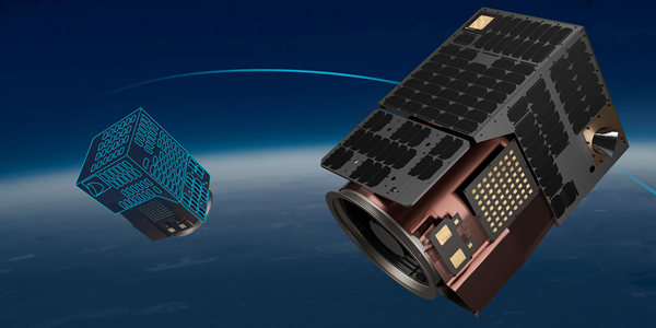
Vertical integration across design, manufacturing, and operations produces efficiencies, which allows us to reduce intermediary costs, control quality, and scale quickly. Through a vertically integrated approach that enables rapid iteration and scalable manufacturing, its low-Earth-orbit satellite constellation, robust platform, and global team deliver accurate and agile solutions to support customer initiatives worldwide.
Satellogic’s technology democratizes the power of Earth Observation by:
- Mapping the world at very high resolution
- Materially increasing the supply of EO imagery
- Reducing the time required to remap the entire world
- Creating unit economics that make EO commercially viable