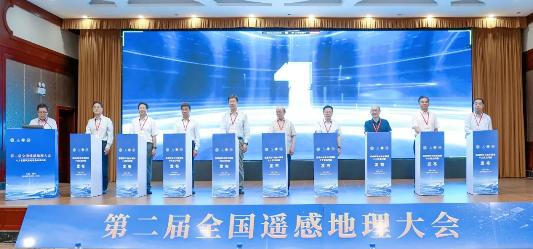
The Aerospace Information Research Institute of the Chinese Academy of Sciences (AIRCAS) announced on August 28 that the Second National Conference on Remote Sensing Geography had opened that day in Kashi, Xinjiang, where the “Top 10 Frontier Questions in Remote Sensing Science and Technology” were officially unveiled.
Academicians and experts said remote sensing in China is rapidly advancing from being able to “see and see clearly” toward being able to “understand, assess accurately and apply effectively.”
Top 10 Frontier Questions in Remote Sensing Unveiled
The newly released frontier questions are:
— Unified cognitive modeling of multidimensional radiative transfer mechanisms in remote sensing.
— Intelligent extraction of remote-sensing information on material and energy cycles within the Earth’s surface system.
— Theories and methods for coordinated observations by virtual constellations of remote-sensing satellites.
— Quantitative retrieval of key geoscience parameters driven by remote-sensing foundation models and AI agents.
— Real-time intelligent processing of multimodal remote-sensing data.
— Remote sensing and exploration of habitable planets and habitable environments.
— Multimodal integration of remote-sensing and social-sensing data to support understanding of coupled human–Earth system processes.
— Remote-sensing tomography of multiscale physical processes in polar ice sheets.
— Near-real-time remote-sensing monitoring and early-warning technologies for natural disasters worldwide.
— Remote-sensing-based prediction of the effects of global climate change on regional ecosystems.
The questions were selected through several rounds of expert deliberation jointly organized by the editorial boards of the Journal of Remote Sensing and Journal of Remote Sensing. They are intended to identify frontier directions for innovation, technological breakthroughs and industrial applications in China’s remote-sensing geography sector.
The questions span three major areas: theory and modeling, observation technologies, and system applications. Together, they reflect remote sensing’s transition from static observation to dynamic prediction, from individual sensing systems to multisource collaboration, and from data acquisition to intelligent decision-making. They also illustrate the field’s increasingly intelligent, systematic and application-oriented development.
China’s Remote-Sensing Data Resources Continue to Expand
Zhang Bing, an academician of the Chinese Academy of Sciences, secretary of the Communist Party of China committee at AIRCAS and chair of the conference, delivered remarks at the opening ceremony.
He said China’s remote-sensing data resources are becoming increasingly abundant as the country continues to strengthen its Earth-observation capabilities. At the same time, rapid advances in artificial intelligence, big data and cloud computing are accelerating the shift from being able to “see and see clearly” toward being able to “understand, assess accurately and apply effectively.”
To meet major national needs, Zhang said, researchers in remote-sensing geography must further unlock the value of multisource data and strengthen their capabilities in intelligent perception, comprehensive understanding, dynamic prediction and decision-support services for geographical environments.
AIRCAS will continue fulfilling its role as a national strategic scientific and technological institution by strengthening fundamental research and breakthroughs in critical core technologies while deepening collaborative innovation with local governments, research institutions, universities and enterprises.
Zhang added that holding the conference in Kashi would help connect frontier research in remote-sensing geography more closely with the practical needs of Xinjiang, particularly southern Xinjiang.
Exploring Deeper Integration Between AI and Remote-Sensing Geography
Themed “AI-Empowered Innovation in Remote-Sensing Geography,” the Second National Conference on Remote Sensing Geography attracted more than 1,000 academicians, experts, researchers and students from research institutes, universities, government departments, enterprises and public institutions across China.
Participants shared the latest achievements in remote-sensing geography and explored new pathways for deeper integration between artificial intelligence and the discipline.
During the two-day conference, academicians delivered invited presentations covering topics including remote-sensing geography in Anthropocene Earth-system research; climate-change patterns across Eurasia and the remote-sensing response to landscape changes in Central and Western Asia; space-based sensing technologies in the AI era; near-real-time remote sensing of sudden surface anomalies and its engineering implementation; the deep structure and accretionary tectonics of the Altai–Junggar region; and challenges in remote-sensing monitoring for low-altitude security.
The conference was jointly hosted by the Committee on Remote Sensing Geography of the Geographical Society of China and AIRCAS. It was organized by the National Key Laboratory of Remote Sensing and Digital Earth and the Kashi Aerospace Information Research Institute.
The program included invited presentations and thematic discussions covering 24 areas, including landforms and geomorphology, water resources and aquatic environments, the cryosphere, the atmosphere, vegetation, agriculture and rural areas, disasters, cities, natural resources, ecology, remote-sensing big data and intelligent processing, remote-sensing foundation models and their applications, and remote sensing in arid regions.
Participants also exchanged the latest research findings in frontier theories, key technologies and major applications while discussing the scientific questions and technological challenges facing the discipline.