Tag: geospatial analytics
-
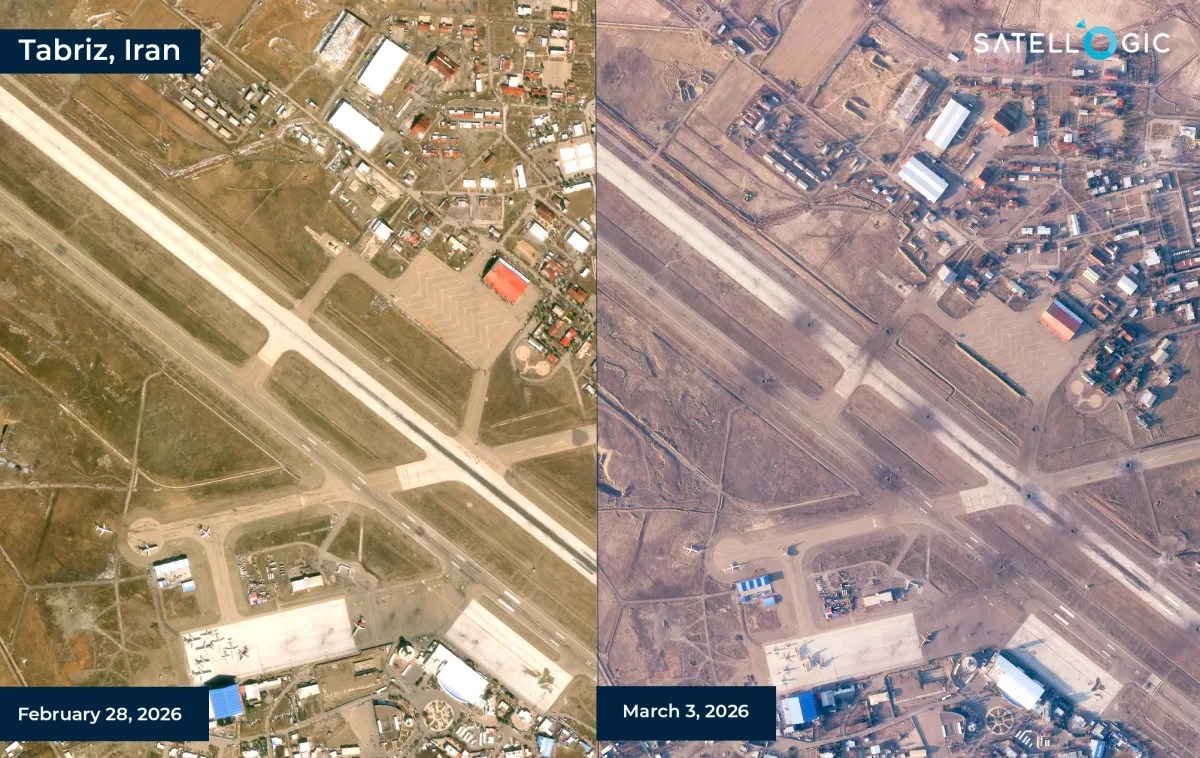
Satellogic and SynMax Partner to Develop AI-Powered Geospatial Intelligence Solutions
Satellogic and SynMax have announced a strategic collaboration to develop geospatial intelligence products that combine satellite imagery with artificial intelligence-driven analytics for defense, intelligence, and security customers. The partnership brings together Satellogic’s Earth observation infrastructure and SynMax’s AI-based intelligence platform, with the companies aiming to deliver persistent monitoring and analysis capabilities across a range of…
-
Hydrosat Raises €51 Million Series B to Expand Thermal Satellite Data Business
Hydrosat, a Luxembourg- and U.S.-based provider of thermal infrared satellite data and AI-powered analytics, said it has raised €51 million ($60 million) in a Series B funding round to accelerate expansion across commercial, civil government and defense markets. The round was led by Hartree Partners, Subutai Capital Partners and Space 4 Earth, with new participation…
-
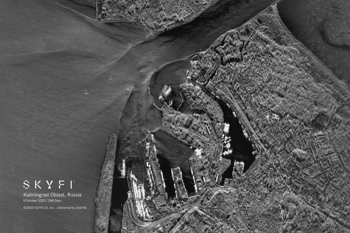
SkyFi Raises $12.7 Million to Expand Satellite Imagery and Analytics Platform
Austin-based startup SkyFi has raised $12.7 million in a Series A funding round as demand grows for faster access to satellite imagery combined with analytical insights, the company said. SkyFi operates a digital marketplace that aggregates imagery from more than 50 geospatial data providers, offering customers near real-time satellite images alongside tools that allow users…
-
Revolutionizing Clean Energy: Wind Farm Mapping Tools That Deliver Results
As the world races toward decarbonization, wind energy has emerged as a vital pillar in the global transition to clean power. With governments setting aggressive renewable energy targets and utilities seeking dependable energy sources, wind farms are popping up across coastlines, plains, and mountain ridges. However, siting and developing a successful wind project involves more…