Satellite imagery is available in a wide range of spatial resolutions, allowing organizations to select data products that best match their operational, analytical, and budgetary requirements. Spatial resolution refers to the size of the ground area represented by a single pixel in an image. In general, higher-resolution imagery provides more detail but may involve larger data volumes and higher acquisition costs.
At STARPATH GLOBAL, satellite imagery is categorized into four primary resolution classes: Very High Resolution (VHR), High Resolution, Medium Resolution, and Low Resolution. Each category is designed to support different operational objectives and analytical requirements.
Very High Resolution (VHR) imagery ranges from 15 cm to 49 cm per pixel. This level of detail enables users to identify individual buildings, vehicles, road markings, utility infrastructure, construction activities, and other small-scale features. VHR imagery is widely used for urban planning, infrastructure inspection, facility monitoring, disaster assessment, defense applications, and asset management where precise visual interpretation is essential.
High-resolution imagery ranges from 50 cm to 1 meter per pixel. It provides an excellent balance between image detail and geographic coverage, making it suitable for regional mapping, transportation planning, land use analysis, environmental monitoring, and infrastructure development projects. Organizations often use high-resolution imagery when they require detailed situational awareness across larger areas while maintaining manageable data volumes.
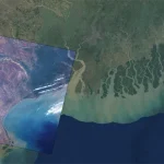
Medium-resolution imagery ranges from 1.5 meters to 5 meters per pixel. This category is commonly used for agricultural monitoring, forestry management, environmental assessment, natural resource management, and large-area change detection. Medium-resolution datasets allow users to monitor extensive geographic regions efficiently while still retaining sufficient detail for many analytical workflows and geospatial intelligence applications.
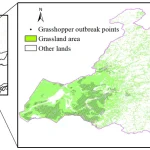
Low-resolution imagery ranges from 5 meters to 15 meters per pixel. These datasets are particularly valuable for large-scale environmental monitoring, vegetation analysis, land cover classification, regional planning, and broad-area trend assessment. While individual structures are typically not distinguishable, low-resolution imagery provides cost-effective coverage for projects involving extensive territories and recurring observation requirements.
Selecting the appropriate resolution depends on the specific objectives of a project. Applications such as construction monitoring, infrastructure inspection, facility management, and urban development typically benefit from VHR or high-resolution imagery. In contrast, agriculture, forestry, environmental monitoring, and regional planning initiatives may achieve better efficiency using medium- or low-resolution datasets that provide broader coverage and more frequent acquisition opportunities.
Beyond spatial resolution, organizations should also evaluate temporal resolution, spectral capabilities, revisit frequency, and geographic coverage when selecting satellite imagery products. The optimal solution often involves balancing image detail, update frequency, area of interest, and analytical requirements to support informed decision-making.
As Earth observation technology continues to evolve, access to multiple resolution options allows organizations to tailor data acquisition strategies to specific operational goals. From detailed facility monitoring using 15 cm imagery to large-scale environmental analysis using 15 m datasets, satellite imagery remains a critical source of geospatial intelligence across a wide range of industries.