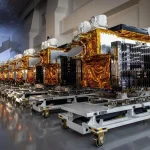
The U.S. Space Force will keep its aging Defense Meteorological Satellite Program (DMSP) spacecraft operating until at least 2028, extending the life of a satellite fleet that was originally designed for much shorter missions but remains important to military weather forecasting.
The decision highlights a transitional period in U.S. military space weather: the Space Force is simultaneously relying on decades-old spacecraft, deploying a new generation of specialized satellites, and experimenting with commercial remote-sensing systems. Rather than replacing DMSP with a single direct successor, the service is breaking its weather mission into multiple satellite programs and combining government, military and commercial data sources.
The three remaining DMSP satellites had been expected to be decommissioned in 2026. Instead, the Space Force now plans to operate them until the functional end of their on-orbit lives, which officials currently expect to occur no earlier than 2028.
The extension follows a requirement in the fiscal 2026 National Defense Authorization Act directing the Space Force to continue operating the satellites as long as possible because their weather data remains valuable to military users and other government agencies, including NASA and the National Oceanic and Atmospheric Administration.
The decision is more than a simple delay in retiring old spacecraft. It reflects the difficulty of replacing a mature global weather-monitoring capability while simultaneously building a more distributed and resilient architecture.
DMSP Is Still Doing a Job That Is Difficult to Replace Quickly
The DMSP program dates back to the 1960s and has provided weather information to the U.S. military for more than five decades. The last three functioning spacecraft were launched in 2003, 2006 and 2009, respectively—far beyond their original estimated five-year service lives.
The satellites operate in sun-synchronous low Earth orbits at roughly 450 nautical miles. Their primary weather sensors provide visible and infrared observations of cloud systems, while the broader DMSP mission has historically supported meteorological and space-weather data collection for military operations.
The Space Force says the remaining spacecraft have experienced degradation in sensors and in systems used to control their attitude and orbit. Nevertheless, officials say the constellation remains resilient and continues to satisfy its primary weather-monitoring requirements.
That longevity is operationally useful but also illustrates the problem facing the replacement program. A satellite does not have to be completely healthy to remain useful, but aging spacecraft gradually lose redundancy, maneuvering capability, sensor performance and tolerance for unexpected failures.
Keeping DMSP alive through 2028 therefore provides the Space Force with something strategically valuable: time.
The service can continue receiving established data while newer systems are tested, calibrated and integrated into military forecasting workflows.
The Replacement Is Being Split Between Microwave and EO/IR Satellites
The Space Force is not building a one-for-one DMSP replacement.
Instead, its near-term architecture divides major DMSP functions between two programs: the Weather System Follow-on-Microwave, or WSF-M, and the Electro-Optical/Infrared Weather System, or EWS.
WSF-M focuses on passive microwave sensing. Its measurements are particularly useful for observing atmospheric and surface conditions that cannot always be characterized adequately through visible imagery.
The Space Force says WSF-M provides high-precision passive microwave measurements supporting observations of winds, cloud cover, snow depth, sea ice and soil moisture. The system is also designed to identify and characterize tropical storms and high winds.
The first WSF-M spacecraft launched in April 2024 and was accepted for initial operations in 2025.
However, the program has experienced delays in reaching full operational capability. The Space Force had previously targeted September 2025 for full operational capability, but testing and resource constraints have pushed that milestone to early 2027.
According to a Pentagon acquisition report released Aug. 3, some of the delay is associated with insufficient operational test resources and personnel at the Air Force’s 557th Weather Wing, which supports the modeling and validation infrastructure used to assess systems such as WSF-M.
The delay does not mean the satellite’s data is unusable. WSF-M is already providing operationally relevant information, while the remaining work is intended to establish the broader system’s complete operational performance.
A second WSF-M spacecraft is scheduled to launch in early 2027 aboard the Space Force’s USSF-178 mission.
That satellite will provide additional resilience as the service gradually moves away from dependence on DMSP.
The EWS Program Recreates Another Part of the DMSP Mission
The other major component is the Electro-Optical/Infrared Weather System.
EWS is intended to provide electro-optical and infrared imagery of cloud cover and other weather features needed by military planners. The first EWS spacecraft is scheduled to launch in 2026 or 2027, with a second planned for 2028.
The program has already gone through an early technology demonstration. The Space Force launched an EWS CubeSat demonstration in 2024 to test technologies intended for the larger operational system.
The use of smaller spacecraft and separated payloads represents an important change from the legacy DMSP model.
DMSP was developed around a relatively concentrated set of capabilities carried by large, highly capable satellites. The newer architecture distributes those functions among multiple spacecraft and potentially multiple providers.
That approach can create advantages in resilience and procurement. Losing one satellite does not necessarily mean losing every weather-sensing capability.
It can also create new integration challenges.
A military weather architecture ultimately depends not only on sensors in orbit but also on ground processing, calibration, data fusion, forecasting models and the ability of military users to incorporate the information into operational planning.
That makes the transition more complicated than simply launching replacement satellites.
Ground Infrastructure Is Becoming Part of the Resilience Equation
The Space Force is also upgrading the infrastructure used to operate the new weather satellites.
The WSF-M command-and-control system is based at the Naval Research Laboratory’s Blossom Point Tracking Facility in Maryland. The Space Force and NRL are developing a cloud-based command-and-control capability that would provide a backup ground node if Blossom Point becomes unavailable.
Three of the four development phases for that cloud-based system have been completed, with the effort expected to finish in 2027.
The significance is broader than weather forecasting.
Modern military space architectures increasingly treat ground systems as potential failure points alongside spacecraft themselves. A satellite can remain healthy in orbit but still become operationally unavailable if its command, communications or data-processing infrastructure is disrupted.
A distributed ground architecture therefore complements the Space Force’s effort to distribute sensing capabilities across multiple spacecraft.
The result is a more layered architecture: legacy DMSP provides continuity, WSF-M adds microwave sensing, EWS restores electro-optical and infrared observations, and commercial systems can potentially fill additional gaps.
Commercial Satellites Are Becoming Part of the Weather Strategy
The Space Force is also testing whether commercially developed spacecraft and data can supplement government-owned weather satellites.
In 2025, the service awarded Muon Space a contract worth about $44 million to modify one of its multispectral imaging payloads for military applications and install the payloads on three satellites for Space Force demonstrations.
This is consistent with a wider shift across U.S. national-security space programs toward hybrid architectures.
Commercial satellite operators can potentially provide additional sensing capacity without requiring the government to design and operate every spacecraft. They can also offer more rapid technology refresh cycles, particularly as commercial Earth-observation companies deploy increasingly capable small satellites.
For weather missions, however, commercial data is not automatically interchangeable with government data.
Military meteorology requires predictable coverage, calibrated measurements, long-term data continuity and secure access. A commercial constellation may offer excellent imagery but still fail to meet a particular military requirement for global coverage, specialized microwave observations or guaranteed availability.
The more realistic model is therefore augmentation rather than wholesale replacement.
Why the United States Is Moving Away From the Old DMSP Model
The transition from DMSP reflects a broader transformation in military satellite architecture.
For much of the Cold War and post-Cold War period, U.S. military space programs relied heavily on large, expensive satellites carrying multiple sophisticated sensors. Those systems provided substantial capability, but replacing them could require long development cycles and significant capital investment.
The emerging model is more distributed.
Instead of asking one satellite to perform many functions, the Space Force increasingly separates missions across specialized spacecraft. This can reduce the consequences of an individual satellite failure and make it easier to introduce new technology.
The tradeoff is architectural complexity.
Operators must integrate data from different spacecraft, manufacturers, sensors, orbits and ground systems. Calibration becomes especially important because measurements from different sensors cannot simply be combined without accounting for differences in resolution, spectral response, viewing geometry and processing.
The DMSP extension effectively gives the Space Force additional time to solve those problems.
China’s Meteorological Satellite Architecture Highlights the Strategic Gap
The U.S. transition is particularly notable when viewed against China’s rapid expansion of the Fengyun meteorological satellite system.
China has developed a coordinated architecture combining geostationary and polar-orbiting meteorological satellites. Recent work on the Fengyun constellation has emphasized coordinated GEO-LEO observations, hyperspectral sensing, microwave remote sensing and improved data fusion.
In 2026, China’s Fengyun-4C geostationary meteorological satellite began returning observation imagery after its Dec. 27, 2025, launch. The spacecraft combines weather monitoring with atmospheric sounding, lightning detection, ionospheric observations and solar-activity monitoring.
China has also said it plans to expand its meteorological satellite architecture during the 2026-2030 period, including development of a geostationary microwave atmospheric sounding satellite.
This creates an important contrast.
The United States is currently extending the operational life of legacy DMSP spacecraft while splitting their functions among WSF-M, EWS and commercial systems. China, meanwhile, is pursuing a coordinated constellation in which GEO and LEO spacecraft are designed to work together as an integrated observation system.
The two approaches are not directly equivalent, because the Chinese Fengyun system is primarily a civil meteorological architecture while the DMSP replacement effort is driven by military requirements. Nevertheless, the underlying technology has strategic overlap.
Weather information affects military aviation, naval operations, missile planning, logistics, maritime activity and space operations.
The ability to observe storms, atmospheric moisture, winds, cloud cover, sea ice and other environmental conditions can directly influence military decision-making.
Weather Satellites Are Increasingly Dual-Use Infrastructure
The strategic value of military weather satellites is sometimes underestimated because weather forecasting appears primarily civilian.
In military operations, however, atmospheric conditions can determine whether aircraft can operate effectively, whether sensors can observe targets, how ships navigate, how logistics networks function and how commanders assess operational windows.
Cloud cover alone can influence optical satellite imagery. Atmospheric moisture affects microwave sensing and radar propagation. Wind and temperature profiles influence aircraft operations and missile trajectories. Sea ice affects naval mobility and Arctic operations.
Space weather creates another layer of concern. Solar activity can interfere with satellite communications, navigation systems and other space-based infrastructure.
This makes weather observation part of the broader information infrastructure supporting military operations.
The Space Force’s decision to preserve DMSP through at least 2028 therefore reflects the operational consequences of allowing a gap to develop between an aging constellation and its replacements.
The 2028 Target Is a Bridge, Not an Endpoint
The current timeline creates a series of important milestones.
The three remaining DMSP spacecraft are expected to remain operational until at least 2028, depending on their actual health.
WSF-M’s first satellite is already providing data, but full operational capability is now expected in early 2027 rather than the earlier September 2025 target.
A second WSF-M satellite is scheduled for launch in early 2027.
The first operational EWS spacecraft is expected in 2026 or 2027, followed by a second satellite in 2028.
The cloud-based backup command-and-control system is also expected to be completed in 2027.
At the same time, commercial weather and remote-sensing demonstrations are being pursued.
That means 2028 should not be interpreted as a hard retirement date for DMSP. It is better understood as the earliest point at which the legacy satellites are expected to reach the end of their functional lives under the current plan.
The spacecraft will continue operating as long as they remain useful and healthy enough to do so.
The Bigger Lesson for Military Space Programs
The DMSP story illustrates a recurring problem in national-security space: replacing a legacy capability can be more difficult than building a technically superior satellite.
The challenge is continuity.
A new spacecraft must produce data that users trust. Ground systems must process it. Forecasting models must be adapted. Operators must be trained. Existing workflows must be modified. The new constellation must provide sufficient coverage and redundancy.
This explains why an apparently obsolete satellite can remain strategically valuable long after its planned service life.
DMSP may be technologically old, but its data is familiar, its operational role is established and its continued availability reduces pressure on a replacement architecture that is still being assembled.
For the Space Force, keeping the satellites flying until at least 2028 is therefore less a retreat from modernization than an insurance policy during modernization.
The emerging architecture will likely look very different from DMSP: smaller and more specialized satellites, separated sensor functions, commercial augmentation, distributed ground infrastructure and greater reliance on data fusion.
If that transition succeeds, the United States will move from dependence on a small number of aging legacy spacecraft toward a more resilient weather-data ecosystem.
Until then, some of the most strategically important weather information supporting U.S. military operations will continue to come from satellites that were launched when the Cold War-era DMSP architecture was still the state of the art.