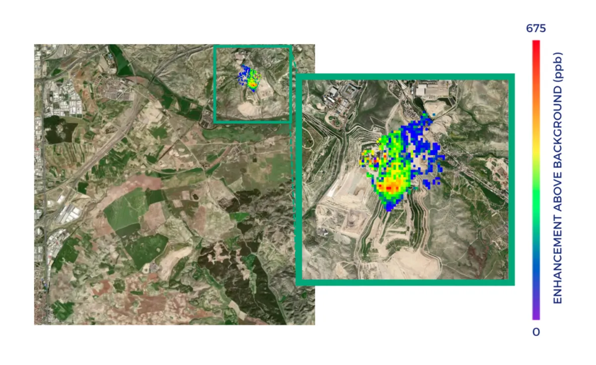
A methane plume over a landfill can tell an operator where to investigate. It does not necessarily identify the gas well, pipe, working face or section of cover that needs repair. The useful question is how far each observation can narrow the search area—and what evidence is needed before assigning a cause.
Three levels of location, three different decisions
Regional hotspot: A wide-area methane instrument can flag an elevated signal around a city or waste-management district. This supports prioritizing areas for closer observation, but the signal may contain contributions from multiple facilities or other methane sources.
Landfill-scale plume: A targeted, higher-resolution methane observation can show an enhancement apparently originating at or near a particular landfill. Plume shape, wind information and the positions of nearby sites help assess attribution. This is evidence for a site investigation, not proof that a particular component has failed.
Within-site source: Aircraft surveys can map smaller features across a facility, while ground teams can inspect suspected areas and check equipment and operating records. A repair decision may require a physical inspection of gas-collection wells, pipelines, covers or active waste areas. Landfill emissions can also be diffuse, so a plume need not trace back to a single broken component.
For the wider role of satellite observations in emissions monitoring, see greenhouse gas monitoring overview. Landfill source attribution requires a more specific chain of evidence.
What the Madrid observations actually showed
In 2021, researchers used the regional view from Copernicus Sentinel-5P to identify a methane hotspot near Madrid. Targeted GHGSat observations then showed plumes from two landfill sites about six kilometers apart. ESA reported a combined estimated emission rate of 8,800 kilograms per hour for an August observation. At that stage, the satellite evidence identified major emitting facilities; ESA said the cause of the releases was unknown.
A separate investigation at Madrid’s Las Dehesas landfill began collecting coordinated satellite, aircraft and ground measurements in 2025. According to ESA, targeted GHGSat observations mapped plumes over the site, aircraft produced finer methane maps, and operators used the findings alongside site information to check suspected leak locations. Maintenance included work on gas-collection wells and pipelines and changes to surface management. Surveys were repeated after that work, but ESA’s account said evaluation of the repairs’ effectiveness was still under way. The published account therefore illustrates a route from detection to targeted maintenance, not a confirmed percentage reduction attributable to the repairs.
A 2025 study in Nature surveyed 151 waste-disposal sites using targeted satellite observations. Its sample included sites with at least one detected plume, so it should not be treated as a census of all landfills or small informal dumping sites. The study also found substantial differences between satellite-based estimates and reported or modeled facility emissions—another reason to combine observations with site records and field work.
Why a plume may be missed—or mislocated
Methane instruments measure an atmospheric enhancement at the time of observation, rather than continuously watching a facility. Cloud cover can prevent a usable measurement. A release may be too weak or diffuse to stand out from background variability; changing wind can disperse a plume or shift it away from its source. Wind direction helps trace a plume upwind, but uncertain or variable winds, nearby emitters and the instrument’s spatial resolution can leave more than one plausible origin.
Detection limits are conditional, not a guarantee for every scene. A 2026 controlled-release study in Atmospheric Measurement Techniques found that emission rate, wind speed and measurement noise strongly affect the probability of detecting a plume with GHGSat instruments. An observation with no detected plume means no qualifying plume was identified under those conditions. It does not establish that the landfill emitted no methane.
Timing matters for follow-up as well. A ground crew arriving hours or days later may encounter different weather or site operations. To evaluate a repair, teams should compare repeat observations with wind, operating conditions and ground measurements in view, rather than treating two satellite snapshots as an uninterrupted record.
A practical investigation workflow
- Screen the region. Review broad-area methane observations together with maps of known landfills, waste facilities and other potential sources. Record the observation dates and whether conditions allowed a usable measurement.
- Reobserve candidate sites. Request targeted methane measurements when conditions permit. Examine plume location, wind direction, nearby emitters and repeat detections. Mark uncertain attribution explicitly.
- Inspect the site. Use an aircraft or drone survey where suitable, then ground measurements and operating records to narrow the search. Check suspected wells, pipes, covers and active areas before assigning a cause or planning a repair.
- Verify after action. Repeat measurements and document what was repaired, when it was repaired and how conditions differed between surveys. Report both any observed change and the limits of the comparison.
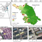
Methane sensing is especially useful for directing attention to strong emissions. It cannot, by itself, inventory every small or unauthorized waste site: a site may have no detectable plume during an overpass. Where the task is to discover unknown dumping locations, land-use change, high-resolution visual imagery and field verification should be considered alongside methane screening.
STARPATH GLOBAL can help scope a monitoring program around the size of the sites, the available methane observations and the level of source attribution the decision requires. Discuss your area with our team to plan the satellite and field-verification steps.
Feature image: GHGSat observation of methane emissions from a Madrid landfill on 20 August 2021, published by ESA. The plume shows an atmospheric enhancement near the facility; it does not identify a specific component requiring repair. Credit: GHGSat/ESA.