
Tag: environmental monitoring
-
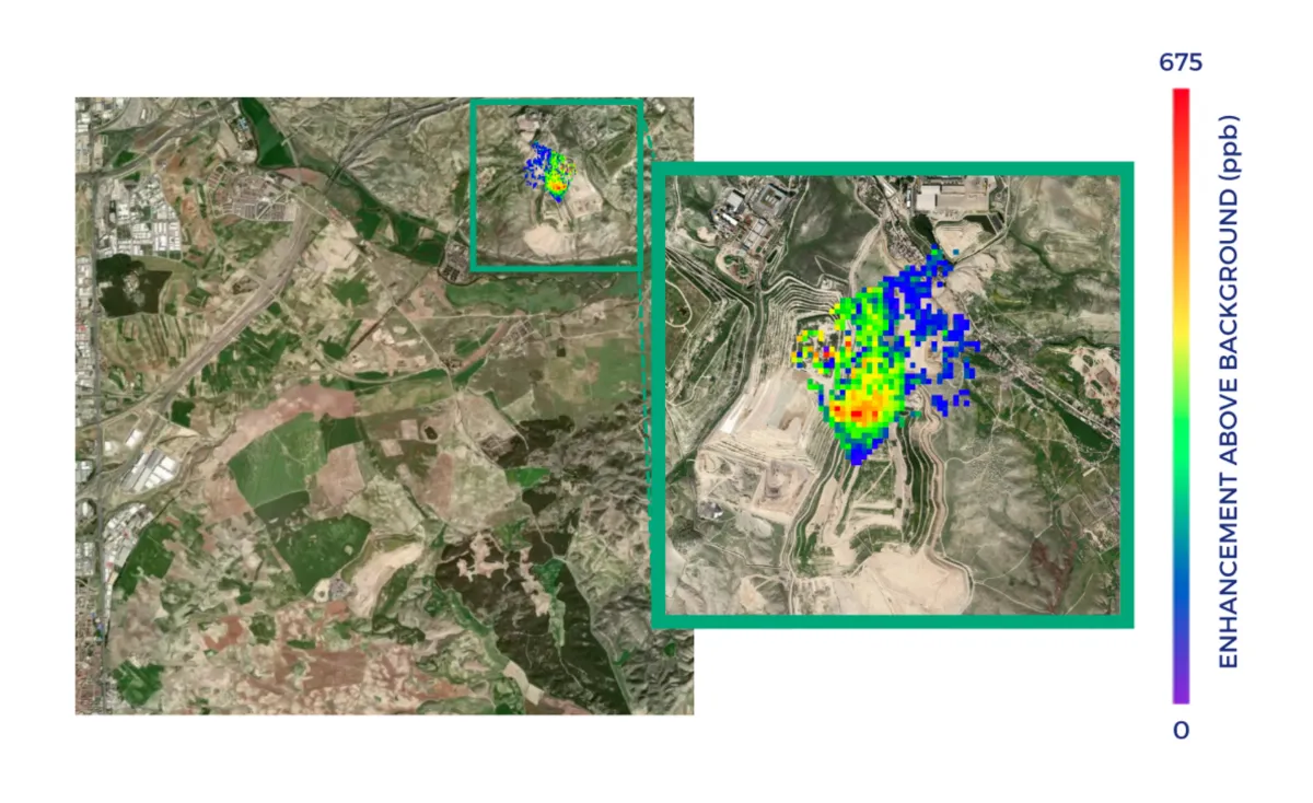
Can Satellites Pinpoint Methane Emissions from a Landfill?
A methane plume over a landfill can tell an operator where to investigate. It does not necessarily identify the gas well, pipe, working face or section of cover that needs repair. The useful question is how far each observation can narrow the search area—and what evidence is needed before assigning a cause. Three levels of…
-
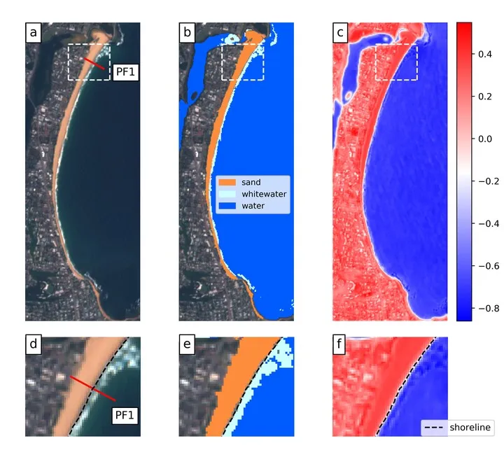
How to Measure Shoreline Change Without Mistaking Tides for Erosion
A shoreline can move landward between two satellite images even when the beach has lost no sediment. A higher tide, stronger wave run-up or a different position within the seasonal beach cycle can all change where water meets land. Measuring coastal change therefore requires more than extracting a clean boundary. The measurement must follow a…
-
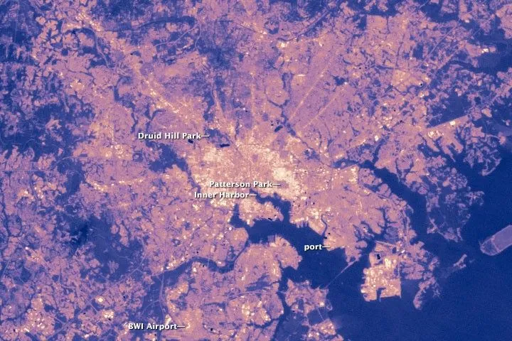
Why Satellite Surface Temperature Differs from Air Temperature
A satellite temperature map can show a hot industrial district while a nearby weather station reports a much lower temperature. Both observations may be correct. The satellite estimates the temperature of visible surfaces, while the station measures the air around its sensor. These measurements describe different parts of the urban environment and should answer different…
-
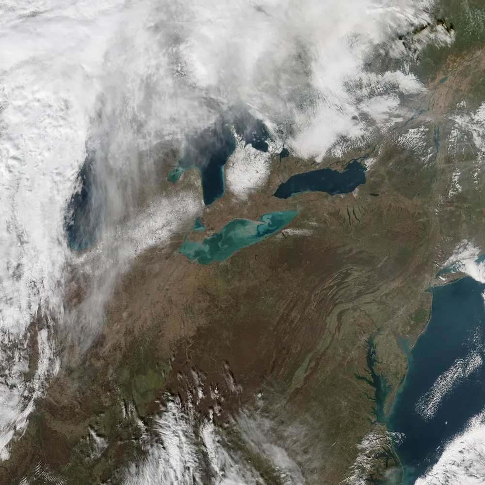
How Reliable Is Satellite-Derived Water Turbidity?
Satellite-derived turbidity can support reliable monitoring of sediment plumes, seasonal patterns and unusual changes across rivers, lakes and coastal waters. Its reliability, however, depends on whether the imagery, processing method and retrieval algorithm have been validated for the conditions being monitored. A convincing map is not enough: users need to know how closely the estimates…
-
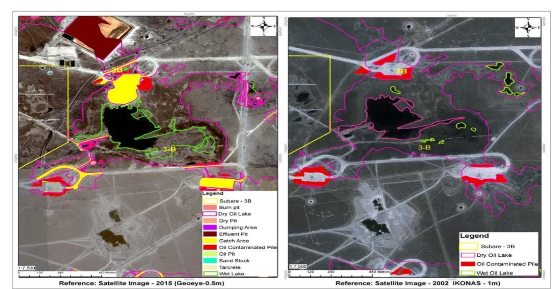
Can Satellite Imagery Detect Oil Spills on Land?
Satellite imagery can help identify some oil spills on land, particularly where contamination is exposed, sufficiently extensive, and observable in suitable spectral bands. It can also reveal surface changes that warrant investigation. But a dark patch near an oil well, an unusual soil color, or declining vegetation does not by itself confirm petroleum contamination. For…
-
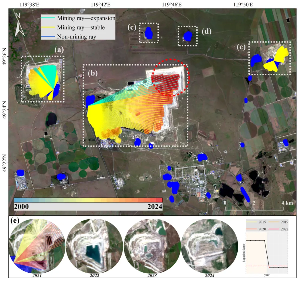
How to Monitor Mining Expansion Using Multi-Temporal Satellite Imagery
Multi-temporal satellite imagery can reveal where a mine’s surface footprint is expanding, which facilities are changing, and how surrounding land is being affected. Reliable monitoring, however, requires more than placing two images side by side. The images must be comparable, the changes must be linked to specific mine features, and the findings must be checked…
-
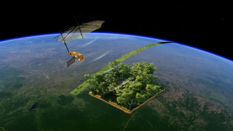
From Carbon Emissions to Carbon Sinks: How Satellites Support Carbon Monitoring
As the world continues to pursue net-zero targets, carbon data is becoming an increasingly important foundation for climate governance, corporate emissions reduction, and ecosystem management. Countries need to quantify and assess greenhouse gas emissions more accurately. Companies need an ongoing understanding of emissions changes across their operations and associated facilities. Carbon markets and carbon projects…
-
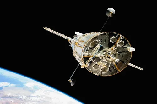
Loft Orbital and NASA JPL Partner to Demonstrate AI Software in Orbit
Loft Orbital has entered into an agreement with NASA’s Jet Propulsion Laboratory (JPL) to host and operate artificial intelligence software demonstrations in orbit as part of a NASA-funded Earth science technology program. The collaboration supports the Federated Autonomous MEasurement (FAME) project, which is funded by NASA’s Earth Science Technology Office (ESTO) and focuses on advancing…
-
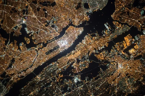
What Is Satellite Imagery? A Guide for Modern Businesses
From monitoring vast agricultural fields to planning the cities of tomorrow, the view from above offers unparalleled insights. Satellite imagery is transforming how industries operate, enabling organizations to make critical decisions with precision and foresight. These “eyes in the sky” provide a wealth of Earth observation data, driving efficiency, enhancing safety, and unlocking new possibilities.…
-
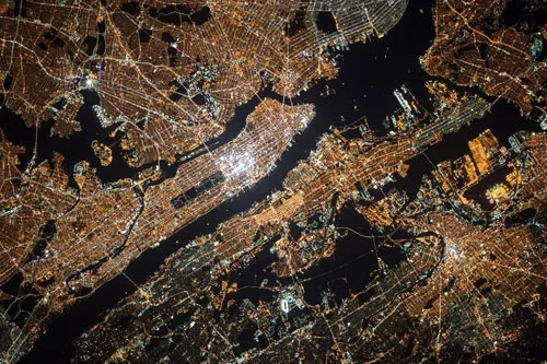
Explaining the Six Components of a Remote Sensing System
A remote sensing system has six components to gather valuable data. In an era of technological advancements, remote sensing technologies have emerged as invaluable tools for understanding and monitoring the Earth’s surface. These innovative technologies enable us to gather data by sensing the energy emitted, or reflected, by a geographical area. Whether for scientific research,…