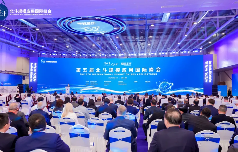
The fifth International Summit on Large-Scale Beidou Applications concluded Sept. 16 in Zhuzhou, Hunan province, after two days of demonstrations spanning consumer devices, drone operations and overseas projects. Organizers unveiled 51 products, technologies and application solutions, while 41 industry and research cooperation projects involving a total planned investment of 5.54 billion yuan were signed. The event showed how China’s Beidou satellite navigation system is being used more widely at home as its international partnerships expand.
At the Huada Beidou booth, an electric bicycle with a dashboard screen demonstrated navigation supported by a built-in Beidou positioning module. Riders can use an app to find where the bicycle is parked and review its travel history.
Another exhibit showed how Beidou can provide a means of calling for help beyond cellular coverage. Outdoor jackets on display incorporated a flexible antenna and carried a Beidou short-message terminal. A wearer in a remote area without mobile service can press a button to transmit location information and a distress message.
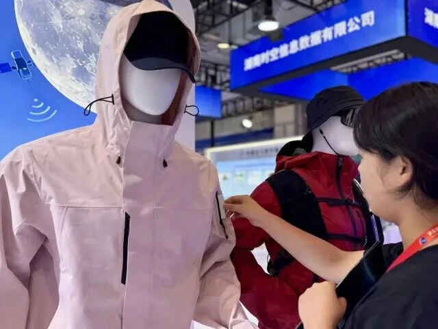
A staff member takes a Beidou short-message terminal out of the outdoor jacket.
In Zhuzhou’s Lusong clothing market, an integrated positioning project uses more than 1,000 indoor beacons across seven floors. It switches between submeter positioning outdoors and accuracy within three meters indoors. Shoppers can use their phones to find individual stalls, while market managers can track goods and locate people during an emergency. The project was presented as the first integrated indoor and outdoor positioning demonstration in a Chinese clothing market. Zhuzhou has planned 135 Beidou application scenarios citywide, of which 49 have been completed.
New chips, drones and production capacity
The 51 innovations released at the summit included positioning chips, short-message modules and industry solutions. Shanghai Sinan Satellite Navigation Technology displayed a fourth-generation positioning chip that the company said improves resistance to ionospheric interference, helping reduce location jumps and errors in recorded travel paths. Hunan Zhongdian Xinghe Electronics presented the XHC-916, a baseband chip designed for low Earth orbit navigation augmentation.
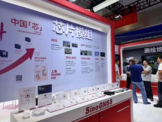
Sinan Navigation chip modules on display.
Beidou’s role in low-altitude operations was visible in an outdoor display by Hunan Xinyi Intelligent Technology Development Co. Its Ark series logistics drones use centimeter-level positioning for medical deliveries, including emergency medicines and laboratory samples between urban buildings. A company representative said a continuous position and timing reference supports flight safety, automatic takeoff and landing, and route planning.
Zhuzhou is also building capacity to manufacture satellites and related systems. Liu Tong, general manager of Hunan Siderite Satellite Technology Co., said the company has built a 34,000-square-meter intelligent factory in the city with capacity to produce 150 satellites weighing less than one metric ton each per year. The summit’s 41 signed projects cover areas including Beidou chip development, spatial data transactions, commercial space and terminal manufacturing.
Another innovation, a satellite-based navigation augmentation system combining Tiantong and Beidou, was jointly developed by China Telecom’s satellite communications branch and the Chinese Academy of Sciences’ Aerospace Information Research Institute. It has been applied in smart agriculture, marine surveying and meteorological monitoring.
International cooperation moves toward local applications
The summit brought 170 international guests from 34 countries and regions to Zhuzhou. Its exhibits highlighted existing Beidou applications abroad, including real-time positioning for workers and vehicles at a gold mine in Nigeria and continuous deformation monitoring at the Usoi Dam near Lake Sarez in Tajikistan.
At a forum on Sept. 15, organizers unveiled a Beidou application cooperation node in Brazil and an innovation base in Malaysia. China Space Time Information Group also signed a roadmap with Kazakhstan’s National Center of Geodesy and Spatial Information to establish a cooperation node there. A training program for participants from Belt and Road countries addressed the local skills needed to operate and apply Beidou services.
These projects extend the summit’s focus beyond exporting navigation equipment to developing locally usable services and technical capacity. Together with Beidou applications in agriculture, disaster monitoring and fisheries management, they show how positioning and timing services are being adapted to different countries’ operational needs.
Beidou’s expanding international partnerships are one example of how China’s space industry is serving overseas markets. As satellite production capacity grows across China, international customers have more opportunities to source competitively priced satellites, payloads and assembly, integration and test (AIT) services. STARPATH GLOBAL helps teams assess these options against their mission requirements; customers can discuss your requirements with STARPATH GLOBAL to identify solutions suited to their technical needs and budgets.