
Author: starpathwp-production
-
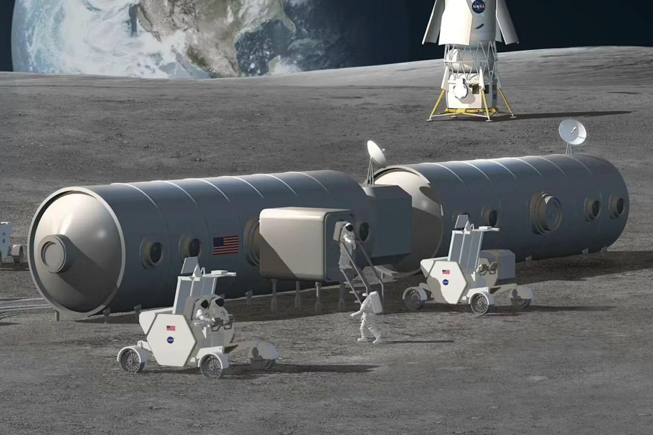
NASA and Energy Department Sign Space Nuclear Pact as Isaacman Says Moon Base Runs Ahead of Schedule
The agreement implements President Donald Trump’s December 2025 space superiority executive order and a White House memo, NSTM-3, which launched a national space nuclear power initiative. The summit followed up on a July report of the same name, hosted by the White House Office of Science and Technology Policy. The MoU sets a framework for…
-
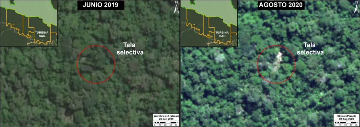
Can Satellite Imagery Detect Selective Logging?
Satellite imagery can detect some selective logging, particularly when tree removal creates visible canopy gaps, new access routes or repeated changes in the radar signal. However, detecting a large clear-cut is a different task from identifying scattered tree removal beneath a mostly intact canopy. The reliability of the result depends on the disturbance footprint, forest…
-
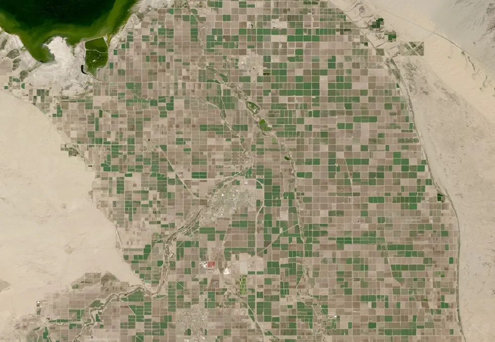
What Can Satellite Imagery Actually Tell You About Crop Health?
Satellite imagery can reveal where crop growth is uneven, how vegetation changes through the season, and which areas deserve closer inspection. It can also support estimates of canopy cover, biomass and water-related conditions. But a vegetation map does not, by itself, establish whether a crop is diseased, short of water or likely to produce a…
-
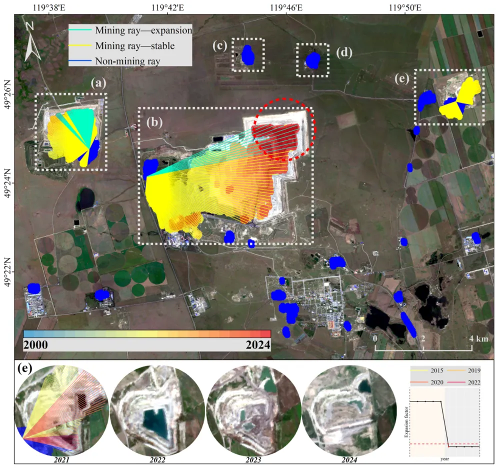
How to Monitor Mining Expansion Using Multi-Temporal Satellite Imagery
Multi-temporal satellite imagery can reveal where a mine’s surface footprint is expanding, which facilities are changing, and how surrounding land is being affected. Reliable monitoring, however, requires more than placing two images side by side. The images must be comparable, the changes must be linked to specific mine features, and the findings must be checked…
-
Satellite Revisit Time vs. Actual Monitoring Frequency
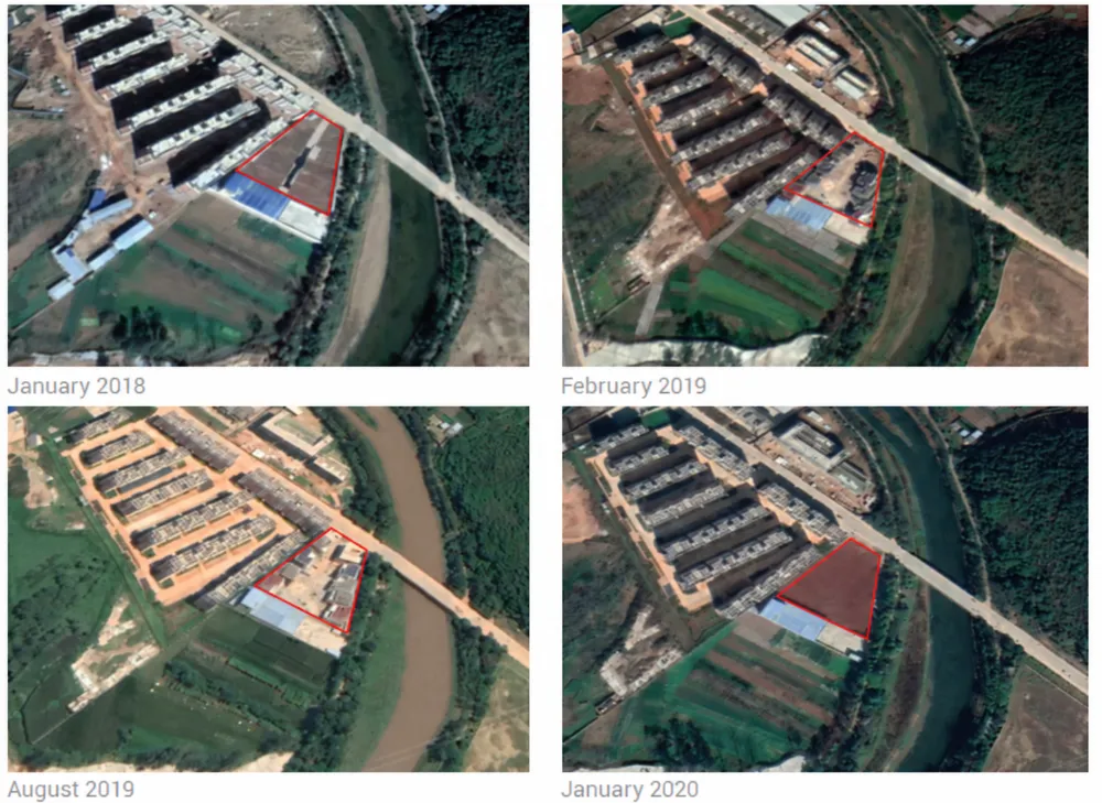
A satellite may be able to revisit your site every few days, yet the interval between usable images can be much longer. Clouds, acquisition schedules, viewing conditions and delivery requirements all affect when a new observation becomes useful. For monitoring projects, the key question is not simply how often a satellite can see the target,…
-
Why Satellite Monitoring Fails Under Cloud Cover — and When SAR Helps
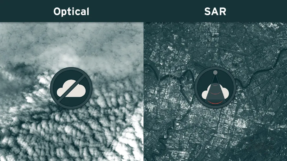
A satellite may pass over a mine, port or infrastructure corridor on schedule and still produce no usable optical view of the site. Clouds can hide the ground, while cloud shadows and haze can make visible areas unsuitable for reliable analysis. Synthetic aperture radar (SAR) can maintain observations through cloud cover and darkness, but it…
-
Can Satellite Imagery Detect Early-Stage Construction?
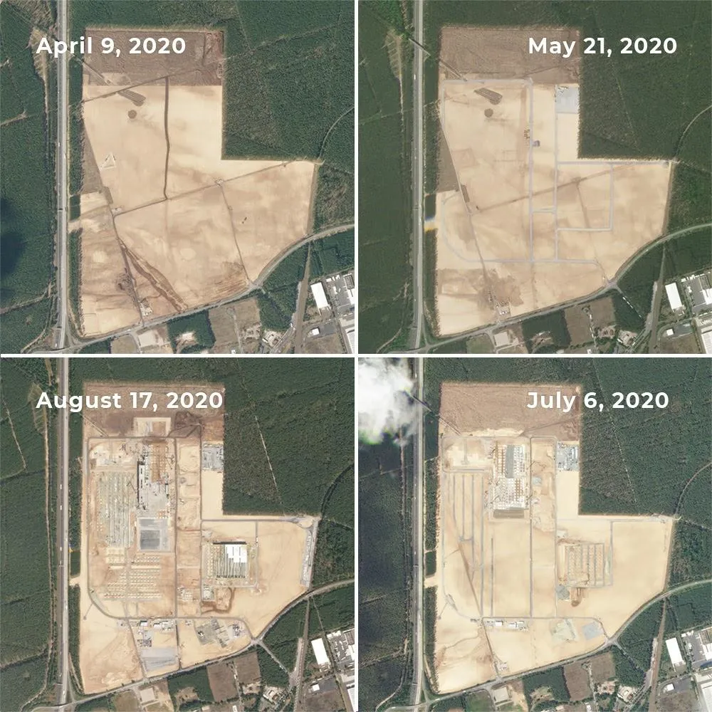
Satellite imagery can reveal construction activity before a building is completed—and sometimes before its structure appears. Land clearing, exposed soil and expanding work areas can provide early signals. But reliably identifying a small foundation or building extension requires much finer imagery than detecting a large construction site. The result depends on the size of the…
-
How to Assess a Satellite Thermal Control Company’s Competitive Edge and Growth Potential
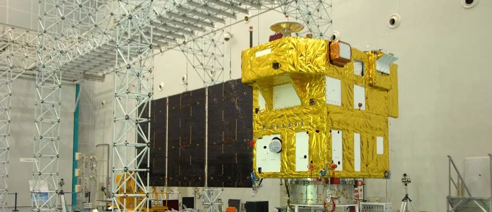
Satellite thermal control may sound like a niche business, but it is critical to a spacecraft’s survival. Yet not every company in the field is equally capable. Some quietly deliver hardware that flies; others excel at telling a compelling story. Assessing a satellite thermal control company requires a closer look at several factors. Technical Capabilities…
-

SpaceX Patents Satellite Beam Timing System for Direct-to-Phone Service
The system addresses a core problem in satellite-to-phone links. When a Starlink satellite forms concurrent radio connections across multiple terrestrial cell footprints, individual devices experience varying signal propagation delays depending on their position relative to the spacecraft’s orbital slant angle. A phone near the center of a spot beam sits closer to the satellite than…
-
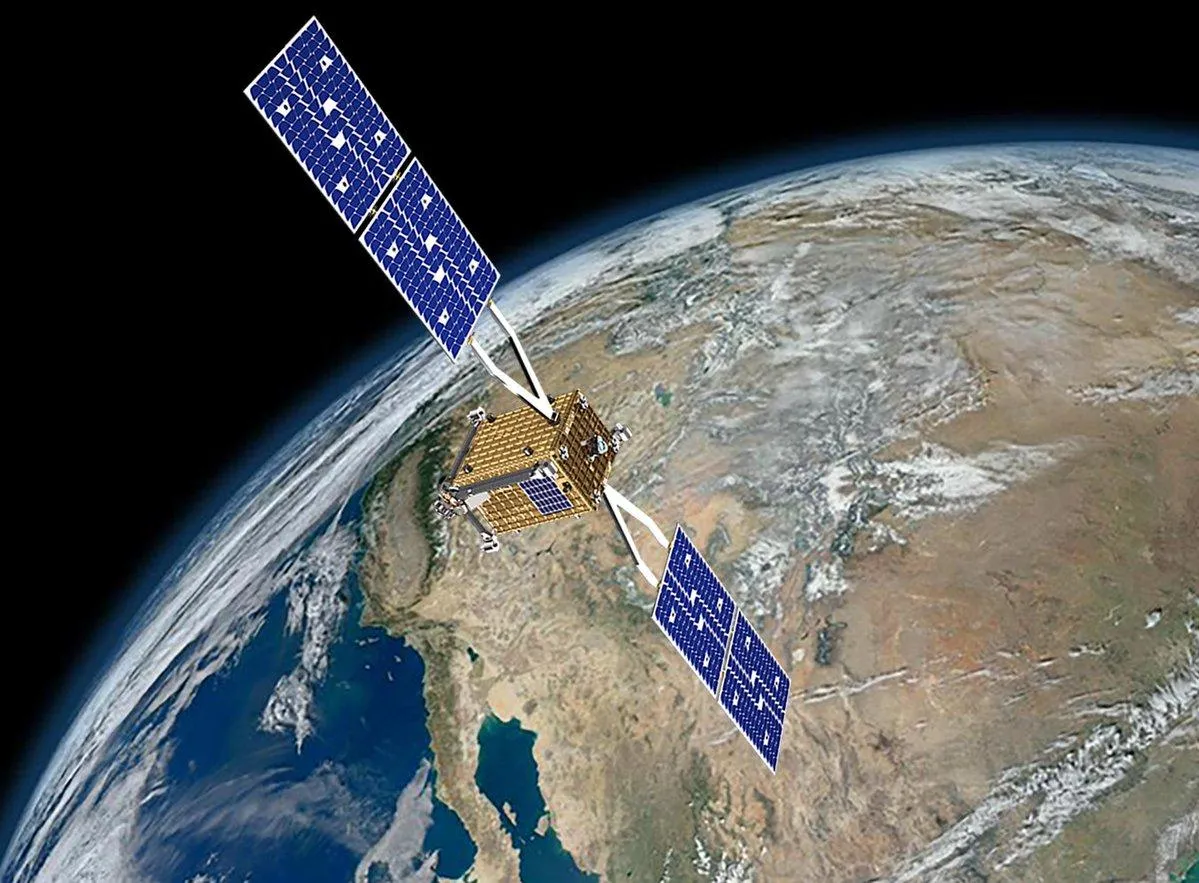
NASA Launches SSPICY to Test Autonomous Inspection of Dead Satellites
The mission addresses a growing hazard in low Earth orbit. Rocket bodies and satellites that are experiencing issues or are no longer in service can break apart or collide, creating orbital debris ranging from large fragments to small particles. With thousands of satellites launched each year for communications, weather forecasting, navigation, and other services, NASA…