
Author: starpathwp-zyj
-

China’s First Open Shared TT&C Platform for Commercial Space Begins Operations in Beijing
China’s first open shared platform for commercial space tracking, telemetry and command (TT&C) services officially began operations Aug. 19 in Beijing, supporting the full measurement and control process for the launch of a Honghu-03 satellite and the recovery of a reusable rocket booster. The Beijing Rocket Street Commercial Space Intelligent TT&C Center, located in Beijing…
-

China Marks 666th Long March Flight with Six Remote-Sensing Satellites
China launched six remote-sensing satellites aboard a Long March 4B rocket Sept. 10, marking the 666th flight of the Long March family and adding new spacecraft for scientific experiments, land-resource surveys, agricultural monitoring and disaster reduction. The Long March 4B ignited at 5 p.m. Beijing time at the Jiuquan Satellite Launch Center and deployed Yaogan-53…
-

China’s New Communications Plan Elevates Satellite Networks in the 6G Roadmap
China’s Ministry of Industry and Information Technology has called for deeper integration between satellite networks and terrestrial communications systems, including satellite-to-phone connectivity, satellite Internet of Things services and the coordinated development of an integrated space network. The requirements are part of China’s Information and Communications Industry Development Plan for the 15th Five-Year Plan period, issued…
-
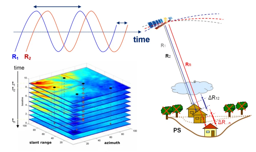
InSAR Monitoring for Infrastructure: Ground Subsidence and Geohazard Assessment
As the old saying goes, it’s better to catch a problem while it’s still small. For infrastructure such as railways, highways, bridges, tunnels, and buildings, many risks do not emerge suddenly. Slopes may deform slowly over months or longer. Railway or road foundations may continue to settle. Unusual ground movement may occur around bridges and…
-

China Launches Authorized Operation of National BeiDou Reference Station Data Network
China has launched authorized commercial operation of service data from its national satellite navigation and positioning reference station network. This marks the first national-level authorization of public-data operations in the field of spatial and temporal information infrastructure. It will help transform the reference station network’s underutilized public data from a public resource into data assets…
-

China Launches International Earth-Moon CubeSat Constellation to Support Future Lunar Bases
China has formally launched the International Earth-Moon CubeSat Constellation Big Science Program, which aims to deploy 30 CubeSats across cislunar space in six batches. The preliminary schedule targets the completion of all launches and deployments around 2030. The satellites will conduct space-environment monitoring, gamma-ray burst observations and lunar-resource surveys, generating data intended to support future…
-

‘Xuelong’ Receives and Processes HY-1E Data in Arctic, Expanding Real-Time Satellite Support for Polar Navigation
China’s icebreaker Xuelong successfully received and processed data from the HY-1E ocean-color satellite while sailing at high speed in the Arctic on Aug. 27, marking the first time the vessel’s shipborne satellite remote sensing system has acquired and processed data from the new-generation satellite in the region. The system maintained stable tracking of the HY-1E…
-
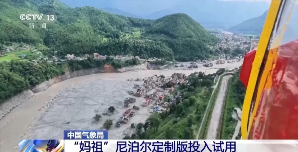
China Uses Fengyun Satellites and MAZU to Support Cross-Border Disaster Monitoring in Nepal
On Aug. 26, a high-altitude ice-and-rock avalanche occurred on the Nepalese side of the border, triggering a chain of cross-border debris flows that caused significant casualties and left people missing at Gyirong Port in China’s Gyirong County. Following the disaster, the China Meteorological Administration activated the Fengyun International User Disaster Prevention and Mitigation Emergency Support…
-
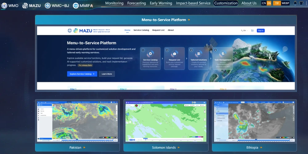
China’s MAZU System Brings AI-Powered Early-Warning Capabilities to Weather-Vulnerable Regions
China is expanding an artificial-intelligence-based weather early-warning solution to developing countries, combining satellite observations, radar, buoy measurements and numerical weather models to deliver localized forecasts and alerts even where computing and communications infrastructure remain limited. Known as MAZU, the system was developed by the China Meteorological Administration to support global disaster-risk reduction and the United…
-
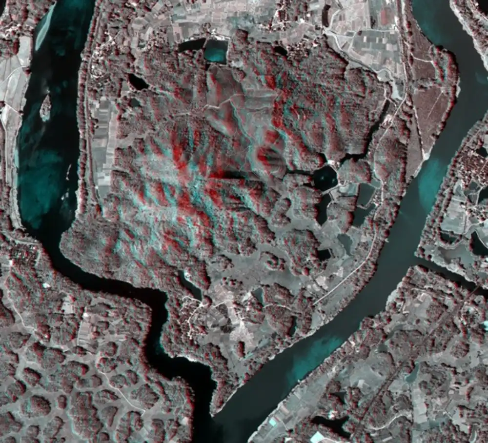
China Achieves Centimeter-Level 3D Imaging With Compact, Low-Power Remote-Sensing System
Chinese researchers have developed a compact remote-sensing system capable of centimeter-level, high-resolution three-dimensional imaging while operating under tight size and power constraints, addressing a persistent payload-design challenge for satellites, unmanned aerial vehicles and autonomous machines. China’s State Administration for Market Regulation disclosed the achievement on September 2. The research was led by the administration’s Key…